Introduction
Nestled deep within the rugged Himalayan terrain of Pangi Valley, a region known for its extreme topography, fragile geology, and limited accessibility, infrastructure development presents unique engineering challenges. The valley, characterized by steep mountain slopes and proximity to major river systems such as the Sutlej River, is highly susceptible to landslides, especially during seasonal variations.
In one such critical event, a significant landslide resulted in the complete blockage of a key road corridor, disrupting connectivity and posing serious risks to mobility and safety. Given the strategic importance of the route, rapid assessment and precise geospatial analysis were essential to enable timely restoration and long-term slope stabilization.
.jpg)
Project Objective
The primary objective of this project was to conduct a high-accuracy geospatial survey to assess the extent of landslide-induced displacement, calculate the volume of debris, and provide actionable data to support engineering interventions.
The project was executed in collaboration with the Border Roads Organisation, with a focus on delivering reliable and time-sensitive data under challenging terrain conditions.
Site Challenges
The project environment posed significant logistical and technical challenges. The landslide zone was located on a steep slope directly above a river system, increasing the complexity of operations and risk factors. The terrain was unstable, with loose rock formations and active slide zones, making physical access both difficult and hazardous.
Additionally, the remote location meant limited accessibility for traditional survey equipment and manpower. Weather conditions and altitude further constrained operational windows, demanding a solution that was both efficient and minimally intrusive.
.jpg)
Methodology
To address these challenges, a hybrid approach combining UAV-based aerial mapping and DGPS ground survey was deployed.
High-resolution drone flights were conducted to capture detailed imagery of the affected zone. The aerial survey was carefully planned to ensure complete coverage of the landslide area, including critical slope sections and surrounding terrain. Simultaneously, DGPS points were established across accessible locations to serve as ground control points, ensuring high positional accuracy in the final dataset.
The integration of UAV imagery with DGPS data enabled the generation of precise orthomosaics and high-density 3D surface models. This approach ensured both spatial accuracy and comprehensive terrain representation.
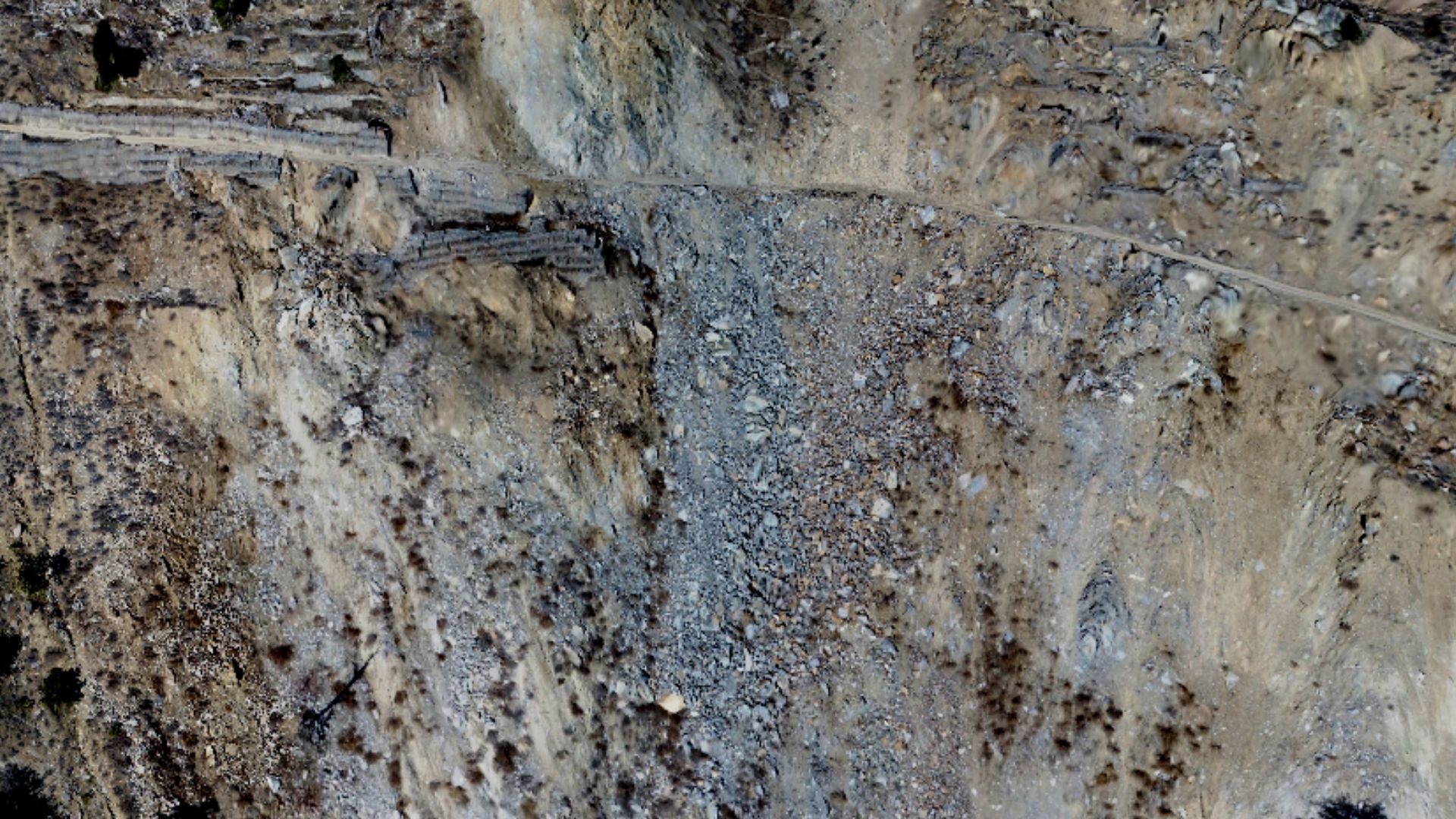
Visual Intelligence & Data Outputs
The collected data was processed using advanced photogrammetry workflows to generate a suite of geospatial outputs. These included high-resolution orthophotos, digital elevation models, and detailed 3D terrain visualizations.
Drone imagery provided a clear and comprehensive view of the landslide zone, capturing both macro-level terrain features and micro-level surface details. Orthophoto outputs allowed accurate mapping of the affected area, while elevation models enabled detailed slope and contour analysis.
The visual dataset played a critical role in understanding the scale and behavior of the landslide, offering engineers a reliable basis for decision-making.
.jpg)
Volumetric Analysis
A key component of the project was the accurate calculation of the volume of displaced material. Using pre- and post-event surface data derived from UAV mapping, volumetric analysis was performed to quantify the total debris generated by the landslide.
This analysis provided precise measurements of material displacement, enabling effective planning for debris clearance and slope stabilization. The high level of accuracy eliminated uncertainties typically associated with manual estimation methods.
Engineering Intervention
Based on the geospatial insights and volumetric data provided, slope stabilization measures were designed and implemented. A critical component of the solution involved the installation of stone mesh reinforcement across vulnerable sections of the slope.
The mesh system was strategically deployed to contain loose rock material and prevent further slope failure. The accuracy of the survey data ensured optimal placement and design of these reinforcements, enhancing their effectiveness and durability.
Impact and Results
The deployment of UAV and DGPS survey techniques enabled rapid data acquisition and high-precision analysis, significantly reducing the time required for assessment and decision-making. The project facilitated timely restoration of the blocked road, minimizing disruption in the region.
The use of drone-based mapping not only improved operational efficiency but also enhanced safety by reducing the need for manual intervention in hazardous zones. The accurate volumetric data ensured effective resource planning, while the stabilization measures contributed to long-term slope security.
.jpg)
Strategic Significance
This project highlights the critical role of advanced geospatial technologies in disaster response and infrastructure resilience. In regions like Pangi Valley, where terrain and environmental conditions pose constant challenges, UAV mapping provides a reliable and scalable solution.
The successful collaboration with the Border Roads Organisation demonstrates how technology-driven approaches can enhance the efficiency, safety, and sustainability of infrastructure projects in extreme environments.
The landslide assessment project in Pangi Valley stands as a strong example of how UAV and DGPS survey integration can deliver precise, actionable insights in critical situations. By combining speed, accuracy, and visual intelligence, the project enabled effective restoration and long-term stabilization of a vital road corridor.
As infrastructure development continues to expand into challenging terrains, such technology-driven solutions will play an increasingly important role in ensuring resilience, safety, and operational excellence.