The geospatial industry has always struggled with fragmentation—different tools for mapping, separate engines for cross sections, external systems for raster handling, and complex setups for APIs and deployment. Agniforge Terra is built to eliminate this complexity and bring everything into one seamless, high-performance ecosystem.
Agniforge Terra is not just a platform—it is a complete production environment where geospatial data is created, processed, analyzed, and deployed in real time.
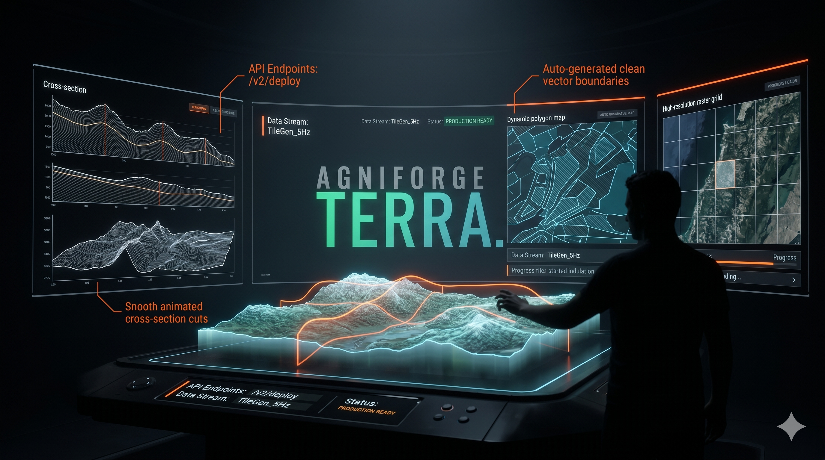
At the core of Agniforge Terra are specialized modules, each engineered for a specific workflow, yet fully integrated into a single system.
Terra Mapper is designed for rapid polygon generation. It enables users to create production-ready polygons in seconds, drastically reducing manual effort while maintaining high accuracy. Whether it's land mapping, planning, or survey boundary creation, Terra Mapper delivers speed and reliability.
Terra XS is the high-performance cross section engine of the platform. It processes large survey datasets and generates detailed cross sections within seconds. With advanced smoothing, elevation adjustments, and fine control options, users can achieve precise results without being limited by automation.
Terra XS Editor enhances this workflow by allowing users to modify and refine cross sections after generation. Instead of reprocessing data, users can directly edit outputs, saving time and increasing efficiency in iterative workflows.
Terra Tiles handles one of the most demanding aspects of geospatial systems—raster data. Large TIFF files are automatically converted into optimized tile layers, ensuring smooth performance and minimal server load. Once processed, a live tile link is generated instantly, which can be used anywhere—web maps, applications, or external platforms.
Terra Cloud is built for handling LiDAR and heavy datasets. It allows users to upload, manage, and visualize large point cloud data efficiently, without compromising performance. The system is optimized to support real-world, large-scale survey operations.
What truly sets Agniforge Terra apart is its instant deployment capability.
With the built-in API system, users can generate polygons or processed data and instantly receive a live API endpoint. There is no need for third-party hosting or complex backend setup. The output is immediately ready for integration into any application or workflow.
Similarly, the tile link generator ensures that raster data is not just processed, but also instantly usable. Once a file is converted, a ready-to-use tile URL is provided, eliminating the need for separate tile servers.
This means every output in Agniforge Terra is not just data—it is a deployable service.
The platform also includes team collaboration features, allowing multiple users to work within the same environment. This improves coordination, reduces workflow delays, and ensures that projects move faster from start to completion.
Agniforge Terra operates on a flexible pay-as-you-use model. Instead of forcing rigid limits, users pay based on actual usage—similar to cloud systems. This ensures fairness, scalability, and cost efficiency for both small users and large enterprises.
From polygon creation to cross section generation, from raster processing to LiDAR visualization, and from data creation to live deployment—everything happens inside a single ecosystem.
Agniforge Terra is not just simplifying geospatial workflows—it is redefining them.
From raw data to real-time deployment, all in one platform.