Mapping at Scale Requires More Than Precision
In modern surveying and mapping workflows, land parcel digitization plays a critical role in project delivery. From real estate planning to infrastructure development, the ability to accurately map high-density plots directly impacts timelines, data quality, and decision-making.
However, traditional digitization workflows—even when using advanced platforms like QGIS—remain heavily dependent on manual interaction. Each polygon requires multiple inputs, continuous alignment adjustments, and repetitive geometry construction.
As project density increases, these limitations become more pronounced, often leading to extended timelines and operator fatigue.
Rethinking the Digitization Workflow
Instead of optimizing the same manual process, a different approach was required—one that reduces dependency on repetitive interaction while maintaining accuracy and structure.
The focus shifted from drawing individual polygons to enabling a system-assisted generation workflow, where minimal input can drive complete polygon creation.
This approach allows:
- Faster polygon generation with reduced manual effort
- Consistent alignment across dense layouts
- Real-time geometry adaptation to surrounding structures
By redesigning the interaction model, the workflow becomes more efficient without compromising output quality.
.gif)
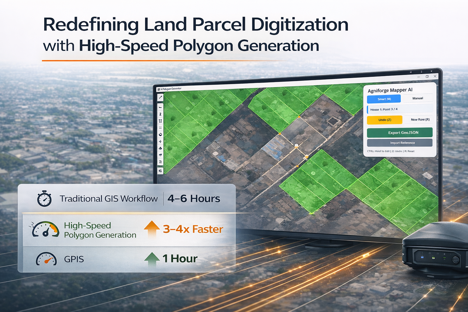
High-Speed Polygon Generation in Practice
With this system, polygon creation is no longer constrained by traditional input-heavy methods.
Each parcel can be generated in approximately one second, enabling operators to work at a significantly higher pace compared to conventional workflows.
In high-density scenarios, this results in:
- Substantial reduction in total digitization time
- Continuous, interruption-free workflow
- Consistent output across large clusters of plots
This shift transforms digitization from a repetitive task into a scalable process.
Structured Output from the Start
Speed alone is not sufficient in professional mapping workflows. Output must be structured, consistent, and ready for downstream use.
To ensure this, each polygon is:
- Automatically assigned a unique identifier during creation
- Aligned within a consistent layout structure
- Generated with minimal spatial conflict or overlap
The result is a dataset that is immediately usable, eliminating the need for extensive post-processing.
Impact on Project Efficiency
This workflow delivers measurable improvements across key areas:
- Reduced Turnaround Time: Large sets of parcels can be digitized significantly faster
- Operational Efficiency: Lower manual effort allows operators to maintain performance over extended sessions
- Scalability: High-density mapping can be handled without proportional increases in time or resources
These improvements enable faster project completion while maintaining professional-grade accuracy.
Enabling Scalable Mapping Workflows
As mapping projects continue to grow in size and complexity, efficient digitization becomes increasingly important.
By reducing manual dependency and enabling high-speed polygon generation, this approach supports:
- Large-scale land parcel mapping
- High-density urban layout digitization
- Efficient data preparation for planning and analysis
This positions the workflow to handle both current and future demands of geospatial projects.
Traditional digitization methods have long limited the speed and scalability of land parcel mapping.
By introducing a system-driven approach to polygon generation, it becomes possible to significantly improve efficiency while maintaining structure and accuracy.
This shift not only accelerates workflows but also enables a more scalable and reliable approach to high-density mapping.