Current Intel Briefing
NEW REPORT
Industrial Intelligence
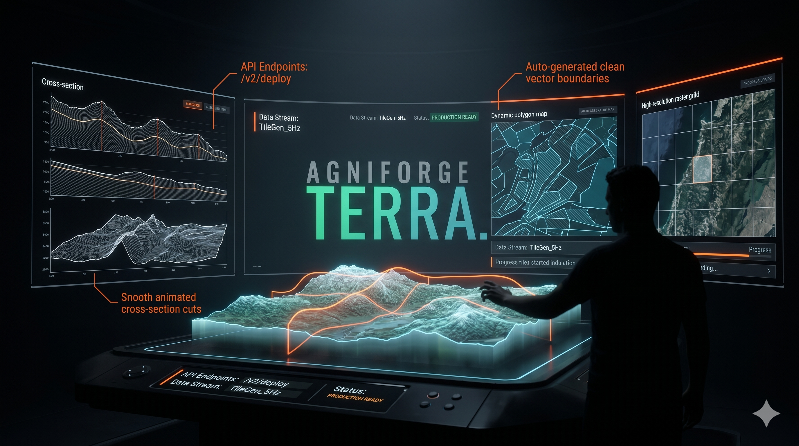
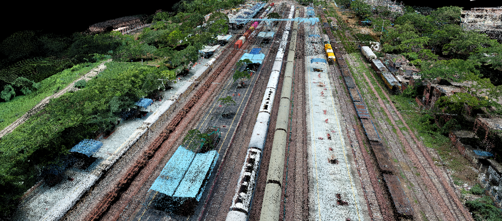
Agniforge Terra: The Unified Geospatial Production Ecosystem
PUBLISHED: 24 Apr 2026, 12:35 PM • READ ANALYSIS ➔
Intelligence Archive
Industrial Intelligence
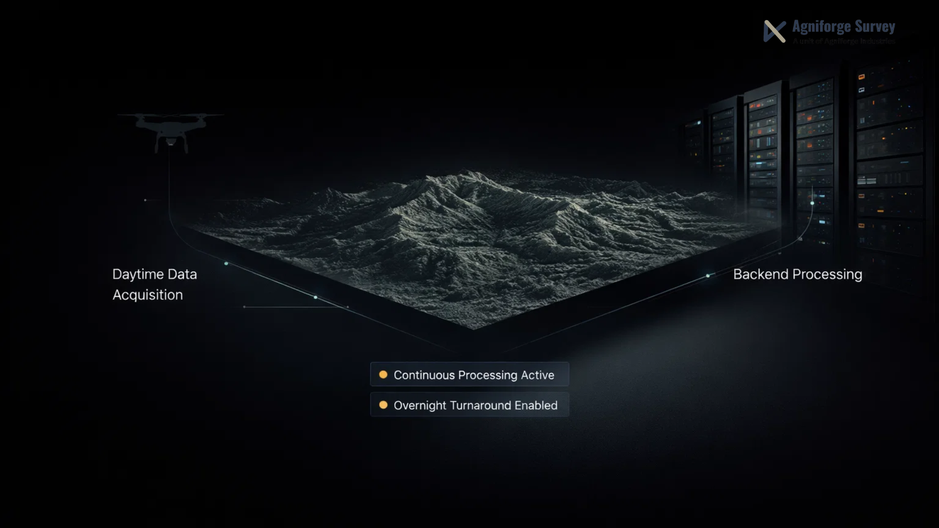
Enabling Continuous Geospatial Data Processing for Global Enterprises
Industrial Intelligence
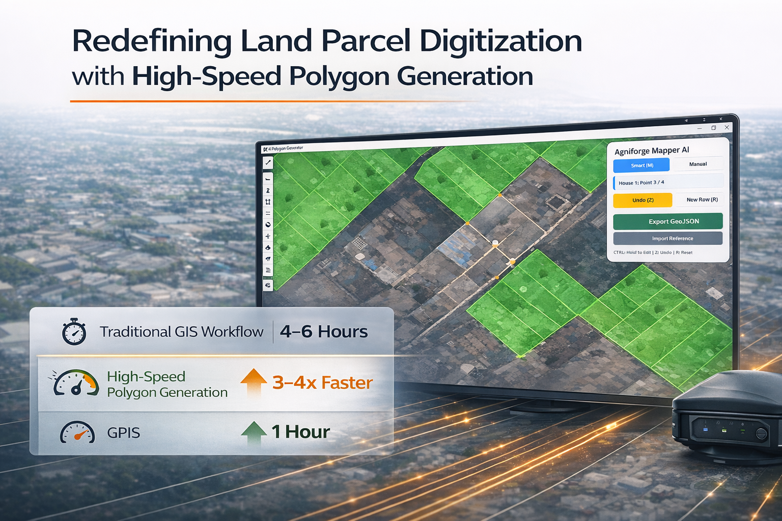
Redefining Land Parcel Digitization with High-Speed Polygon Generation

Infrastructure
Why We Invested in India’s Most Advanced High-Performance GPU Cluster
Learnings
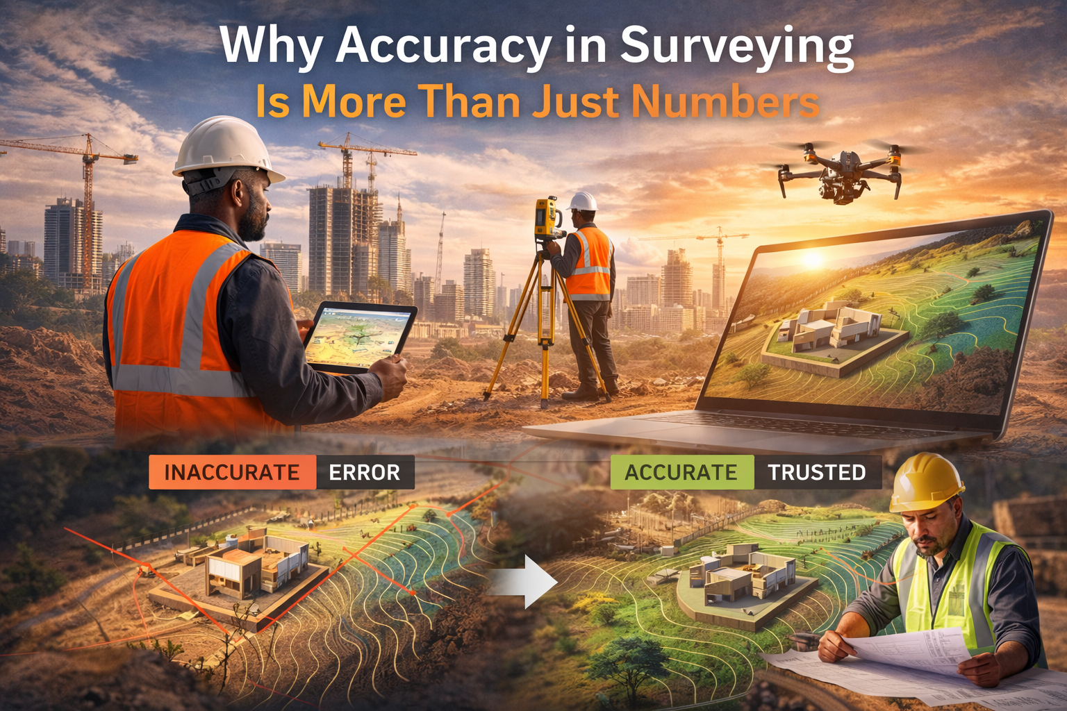
Why Accuracy in Surveying Is More Than Just Numbers
Case Studies
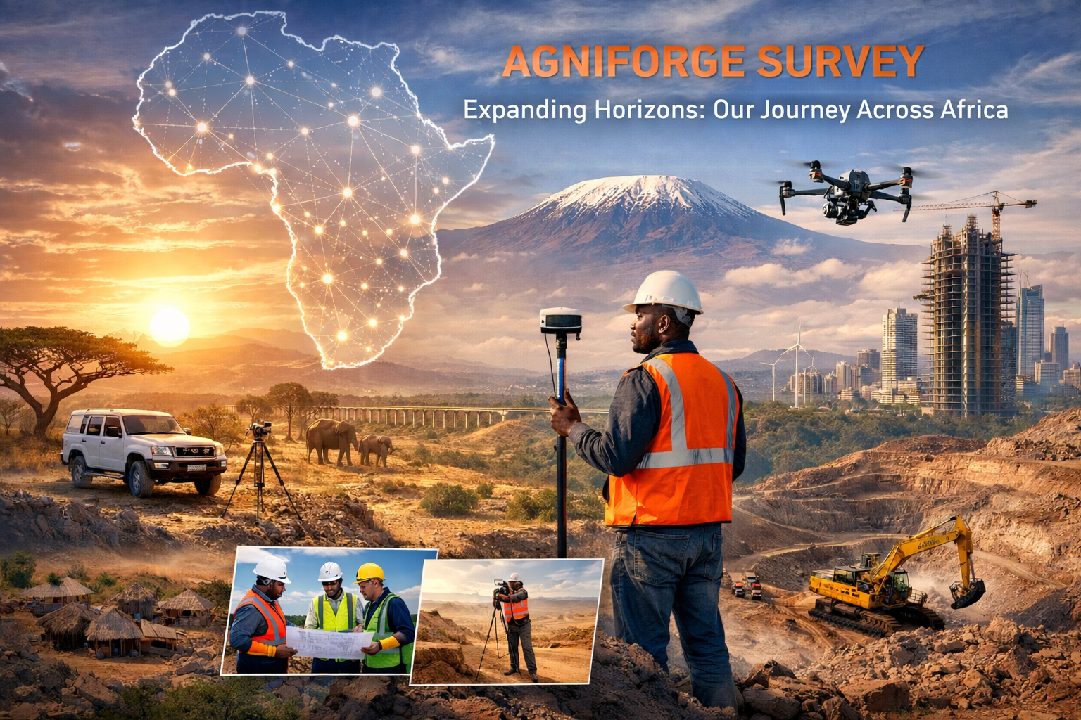
Expanding Horizons: Our Journey Across Africa
Industrial Intelligence
From Local Data to Global Standards: A Small Step in Our Geospatial Journey

Learnings
Ground Data Collection in Drone Survey: The Foundation of Accurate UAV Mapping
Case Studies
Case Study: Rapid Landslide Assessment & Slope Stabilization Using UAV and DGPS Survey in Pangi Valley
UAV Technology
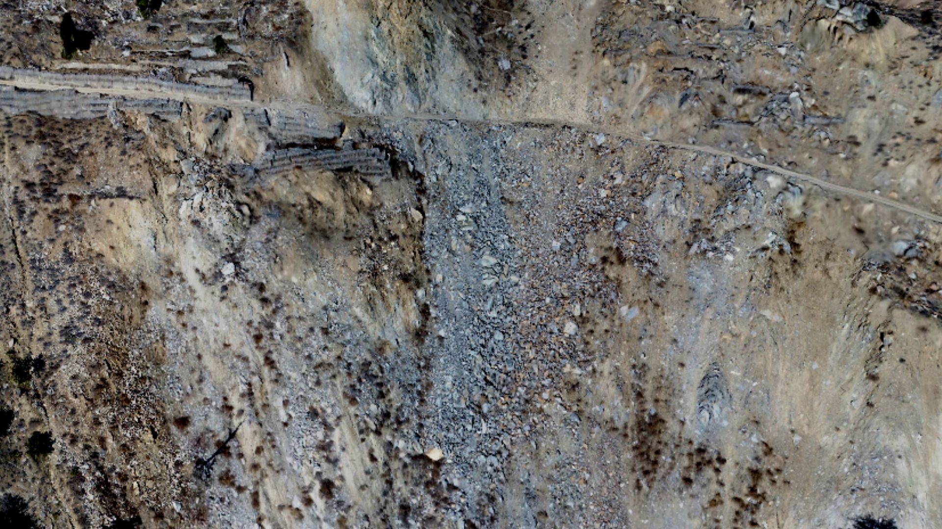
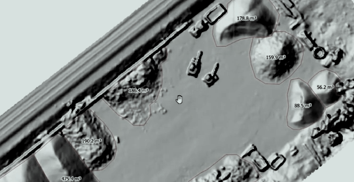
Drone Survey in Mining: Transforming Mine Planning, Volume Calculation, and Safety in India
Industrial Intelligence