Infrastructure development today is no longer just about construction—it is about precision, intelligence, and speed. Whether it is transmission lines stretching across hundreds of kilometers, railway corridors connecting cities, highways shaping economic growth, or high-rise buildings defining skylines, every project demands accurate data and efficient execution. In this evolving landscape, UAV (Unmanned Aerial Vehicle) mapping has emerged as a powerful technology that is transforming how infrastructure projects are planned, monitored, and delivered.
UAV mapping uses advanced drones equipped with high-resolution cameras, LiDAR sensors, and GPS-based positioning systems to capture aerial data with exceptional accuracy. This data is processed using photogrammetry and geospatial software to generate detailed maps, 3D models, elevation data, and actionable insights. What once required weeks of manual fieldwork can now be achieved within hours, without compromising accuracy.
One of the biggest advantages of UAV mapping in infrastructure is its ability to cover large and complex terrains quickly. Traditional surveying methods often face challenges in inaccessible areas such as forests, mountains, rivers, or densely populated urban zones. UAVs, however, can fly over these obstacles effortlessly, capturing continuous and high-quality data. This makes them especially valuable for linear infrastructure projects like transmission lines, pipelines, and railways, where long-distance mapping is critical.
In transmission line projects, UAV mapping plays a crucial role from the initial planning stage to ongoing maintenance. Engineers can use drone data to analyze terrain, optimize route alignment, and determine tower locations with high precision. During inspection, UAVs help identify issues such as vegetation encroachment, structural defects, and thermal anomalies without requiring manual climbing or shutdowns. This not only improves safety but also significantly reduces operational costs and downtime.
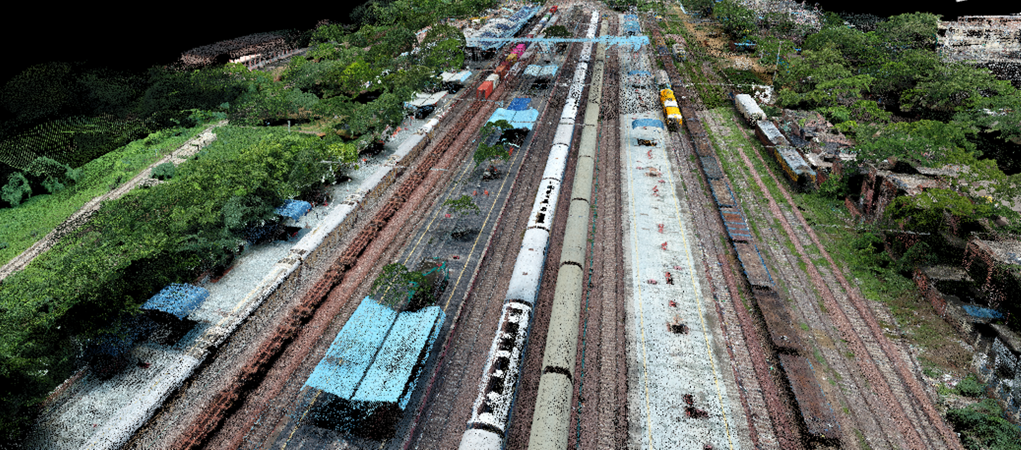
Railway infrastructure is another domain where UAV mapping has proven to be highly effective. Accurate alignment and elevation data are essential for railway design and expansion. UAVs provide detailed corridor mapping, helping engineers understand terrain variations, plan track alignment, and monitor construction progress. Since drones can operate without interfering with active railway lines, they ensure both safety and efficiency during data collection.
In road and highway development, UAV mapping enhances every stage of the project lifecycle. From feasibility studies to final execution, drones provide high-resolution imagery and terrain models that help in route planning and design optimization. Earthwork calculations, such as cut and fill analysis, become more accurate and faster when derived from drone data. Additionally, project managers can monitor construction progress in real time, ensuring that timelines are met and resources are utilized efficiently.
Urban infrastructure and building construction have also benefited greatly from UAV mapping. In smart city projects and large-scale developments, accurate topographic surveys are essential. UAVs enable the creation of detailed 3D models that allow planners and architects to visualize projects before construction begins. During the construction phase, drones can track progress, identify deviations, and support quality control. They also assist in structural inspections, reducing the need for manual intervention in high-risk areas.
Another critical application of UAV mapping is in pipeline and corridor monitoring. Linear assets often face challenges such as encroachment, leakage, and environmental risks. UAVs provide continuous monitoring capabilities, enabling authorities to detect issues early and take preventive action. This ensures compliance with regulations and enhances the overall safety of infrastructure assets.
The technology behind UAV mapping is equally impressive. Photogrammetry allows drones to capture overlapping images and convert them into accurate maps and 3D models. LiDAR technology uses laser pulses to measure distances and generate precise terrain data, even in areas with dense vegetation. Advanced GPS systems like RTK and PPK enhance positional accuracy to centimeter levels. Combined with artificial intelligence and data analytics, UAV mapping can automate feature detection, analyze patterns, and provide predictive insights.
Compared to traditional surveying methods, UAV mapping offers significant improvements in efficiency and cost-effectiveness. Projects that once required large teams and extended timelines can now be completed with fewer resources and in a fraction of the time. The reduction in fieldwork also minimizes risks to human life, especially in hazardous environments. At the same time, the level of accuracy achieved through UAV mapping often surpasses conventional methods, making it a preferred choice for modern infrastructure projects.
Despite its many advantages, UAV mapping does require proper planning and compliance. In countries like India, operators must follow regulatory guidelines set by aviation authorities. Skilled drone pilots and data processing experts are essential to ensure high-quality results. Additionally, managing large volumes of data requires robust processing systems and storage solutions. However, with the rapid advancement of technology and increasing accessibility, these challenges are becoming easier to address.
Looking ahead, the future of UAV mapping in infrastructure is incredibly promising. The integration of artificial intelligence, cloud computing, and real-time data processing is taking drone technology to the next level. Autonomous drone systems are being developed to conduct continuous monitoring without human intervention. Digital twin technology is enabling the creation of virtual replicas of infrastructure assets, allowing real-time analysis and predictive maintenance.
UAV mapping is not just a tool; it is a strategic advantage for organizations involved in infrastructure development. It empowers decision-makers with accurate data, enhances project efficiency, and reduces costs while improving safety. As the demand for faster and smarter infrastructure continues to grow, UAV mapping will play an increasingly central role in shaping the future of development.