Deoghar Leading
Digital Twin Experts.

Surveying the
Digital Twins.

Capturing millimeter-precise geospatial intelligence for national infrastructure projects in Deoghar.

Our Foundation

A Legacy of Vision
and Precision

At Agniforge Survey, we weave precision into progress, transforming landscapes into legacies with unwavering dedication and visionary technology.

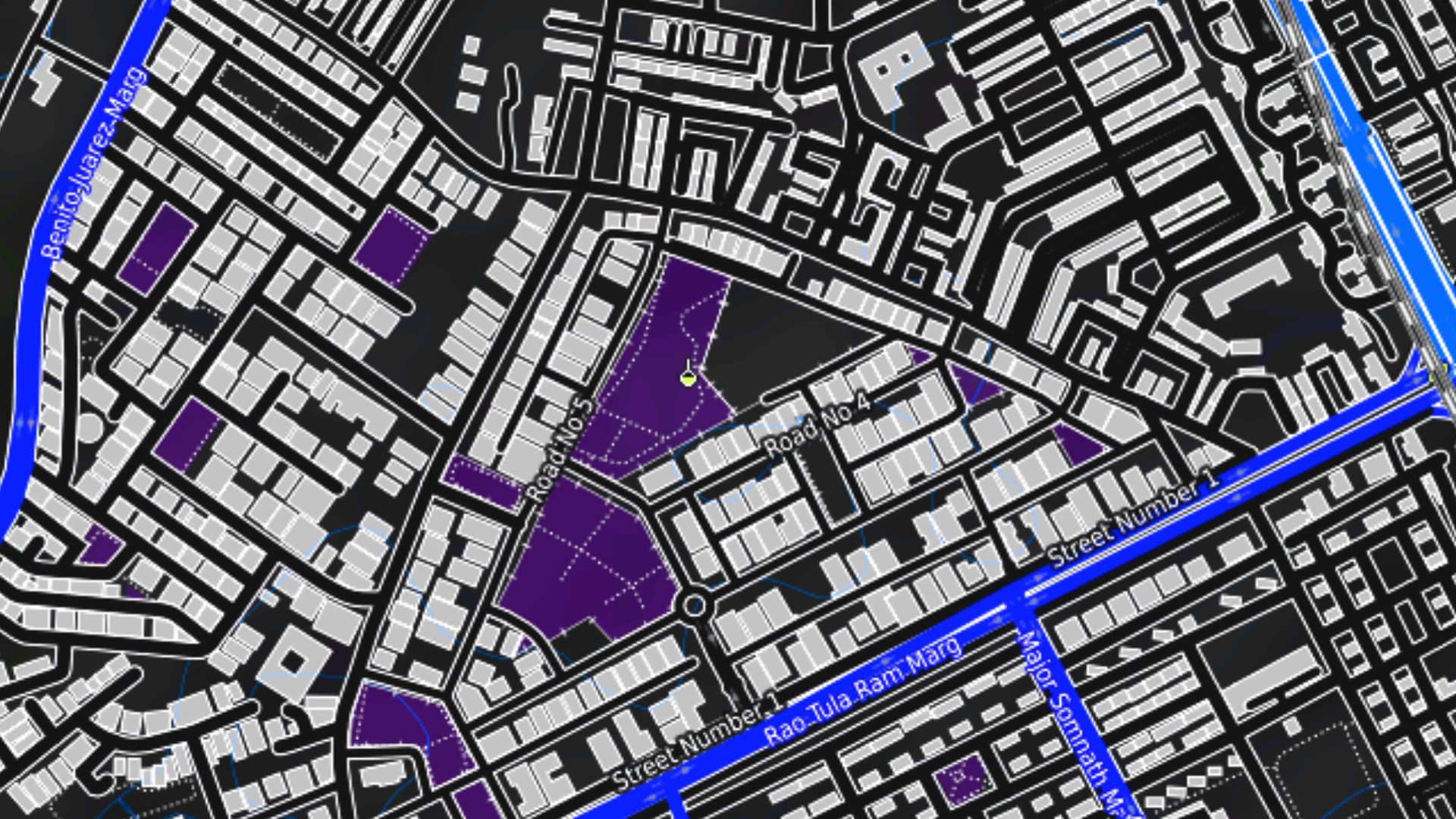
"Rooted in Muzaffarpur, reaching global horizons—blending decades of expertise with UAVs, LiDAR, and Satellite Intelligence."

Our mission is to empower industries with insights that shape a sustainable future. Agniforge is more than a survey company; it’s a beacon of trust and transformation.

UAV LiDAR Survey and Drone Mapping Services in Deoghar
Strategic Capabilities

Empowering Industries with
Digital Precision .

Agniforge integrates orbital data, aerial sensors, and terrestrial precision to build a complete 360° view of your assets in Deoghar..

Remote Sensing &
Digital Twins

Fusing high-altitude Satellite Imagery, UAV Photogrammetry, and LiDAR Scanning to generate centimeter-accurate 3D topographic models for expansive terrains.

  • Millimeter-precise LiDAR Clouds
  • Multispectral Satellite Analytics
  • High-Resolution Orthomosaics

Cadastral &
Land Dynamics

Deploying advanced DGPS Technology to redefine Property Surveys. We provide legal-grade boundary verification and ownership data for urban planning and large-scale development.

  • Centimeter-level DGPS Accuracy
  • Boundary Conflict Resolution
  • Ownership & Title Mapping

Predictive Asset
Integrity

Leveraging Thermal Infrared Imaging and visual AI to detect anomalies, structural defects, and heat signatures across critical industrial infrastructure like solar plants and dams.

  • Infrared Defect Detection
  • AI-Driven Condition Reports
  • Zero-Downtime Inspections

We map with precision.

We digitize the land.

We inspect the anomalies.

We secure the infrastructure.

We are Agniforge.

We map the World.

SYNC_STATUS: 0%
Software Ecosystem

Transforming Raw Data into
Operational Intelligence.

Our proprietary AI engines process complex geospatial datasets to deliver vertical-specific insights with zero latency.

Energy // Wind

Turbyn

Dedicated autonomous inspection engine for wind turbines. Detects hairline cracks and structural fatigue using high-res visual AI.

AI-Defect Analysis Automated Reporting
Launch Platform
Central Data Lab

Surface AI

Our flagship geospatial dashboard. View, measure, and analyze 3D digital twins, orthomosaics, and point clouds in real-time.

3D Cloud Rendering Measurement Tools
Enter Data Lab
Renewables // Solar

Surface AI PV

Specialized thermal intelligence for solar farms. Identify hot-spots, string failures, and panel degradation in minutes.

Thermal Radiometry ROI Forecasting
Solar Audit
Mining // Volumetrics

Myner

Precision mining intelligence. Automated stockpile volume calculation, minesite safety mapping, and haul road analysis.

Volumetric Analysis Mine Safety Mapping
Mining Portal

Developer Hub & Custom Engineering

Integrate Agniforge intelligence directly into your workflow with our high-performance Map APIs and custom GIS Mobile/Web Apps tailored for your specific industrial needs.

Collaborative Ecosystem

Scaling Intelligence Through our Global Network.

Agniforge Projects is our proprietary high-transparency platform connecting elite survey vendors and UAV pilots with large-scale industrial missions.

Real-time Bidding Transparent project allocation and fair market valuation.
Quality Benchmarking Strict SOP compliance through automated data validation.
LIVE_NETWORK_STATUS
50+ Active
500+ Nodes
12.5 TB
Knowledge Hub

Latest Updates.

Deep dives into the world of UAV mapping, LiDAR technology, and AI-driven industrial inspections.

Enter Newsroom ➔
Global Operations

Other Operational Nodes

• Survey in Israel • Survey in Madhya Pradesh • Survey in Lepa Rada • Survey in Garhwa • Survey in Bhopal • Survey in Subarnapur • Survey in Pathankot • Survey in Lagos