Highway Inspection & Survey by Agniforge
Leveraging drones with video geotagging and Network Survey Vehicles (NSV), we deliver precise and comprehensive highway inspections worldwide.
Download Profile
Leveraging drones with video geotagging and Network Survey Vehicles (NSV), we deliver precise and comprehensive highway inspections worldwide.
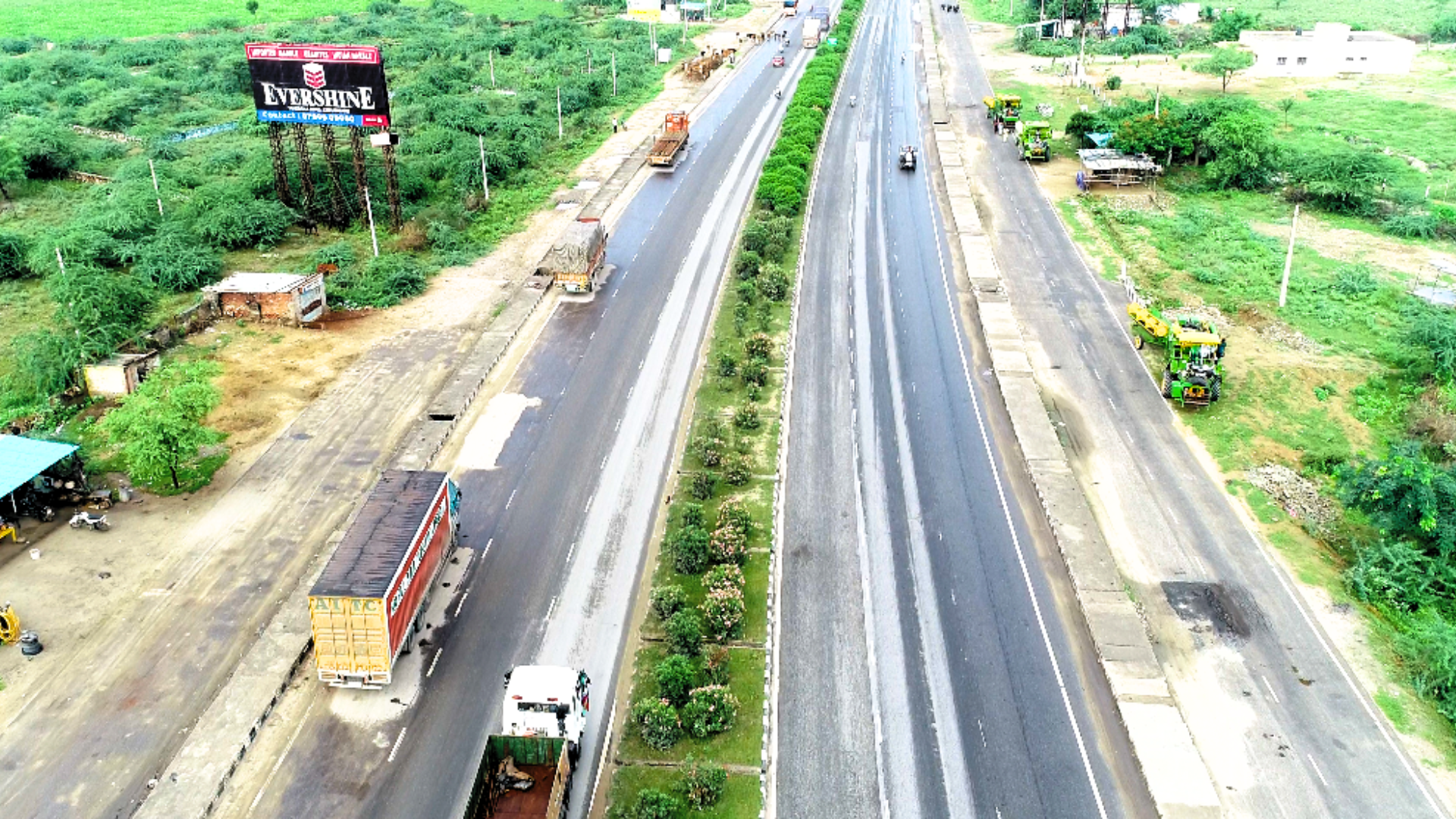
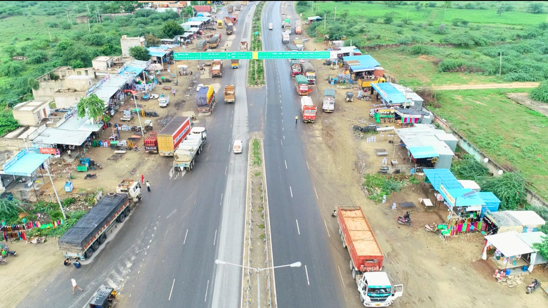
Download ProfileAt Agniforge, our drone-based highway surveys utilize advanced UAVs equipped with LiDAR, high-resolution cameras, thermal imaging, and video geotagging capabilities to deliver precise and efficient inspections. This approach enables rapid data collection and geotagged video documentation over large highway stretches, including remote or inaccessible areas.
Our expert team processes aerial data and geotagged videos to assess pavement conditions, structural defects, and vegetation encroachments, providing actionable insights for highway maintenance and planning. Drone surveys, enhanced by video geotagging, minimize disruption and improve safety by reducing on-ground personnel needs.
With cutting-edge technology and a commitment to excellence, Agniforge’s drone surveys deliver survey-grade results that meet global standards. Partner with us to optimize your highway infrastructure management.
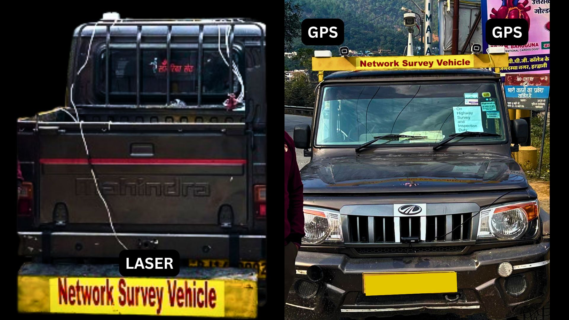
Agniforge’s Network Survey Vehicle (NSV) services provide detailed, ground-based highway inspections using state-of-the-art vehicles equipped with advanced technologies, including a Laser Profilometer with 4 lasers and 6 ultrasonic sensors, dual GPS systems, an elevation profiler, 3 high-resolution pavement cameras, an odometer, and an accelerometer. These tools ensure precise measurement of road surface profiles, geolocation, and vehicle dynamics.
Our NSV surveys capture pavement quality, road geometry, signage conditions, and detailed distress data, such as raveling, potholes, and cracking. Our expert team combines on-ground expertise with advanced analytics to deliver comprehensive insights for highway maintenance, safety, and planning.
With a focus on precision, reliability, and industry-leading standards, Agniforge’s NSV surveys empower clients to enhance the safety and longevity of their highway infrastructure. Partner with us for tailored, data-driven solutions.
Our drone-based highway survey services, including video geotagged surveys, leverage advanced technology for comprehensive and efficient road assessments.
Capture geotagged video footage of highways, enabling precise location-based analysis for maintenance, planning, and documentation.
High-resolution drone imagery to assess pavement conditions, detecting cracks, potholes, and surface wear for maintenance planning.
Precise 3D mapping of highway geometry and terrain using LiDAR, supporting design and expansion projects.
Thermal imaging to identify subsurface defects or drainage issues, enhancing highway safety and durability.
Our NSV-based highway survey services deliver detailed ground-level assessments using advanced technologies for comprehensive road management.
Assess road smoothness using laser profilometers to ensure optimal ride quality and driver comfort.
Measure surface deformations with precision sensors to address safety concerns and prevent further damage.
Analyze distresses like raveling, potholes, cracking, and bleeding using high-resolution cameras for targeted solutions.
Deliver detailed reports with practical recommendations to guide road maintenance and rehabilitation efforts.
Our drone-based highway surveys, including video geotagged surveys, address critical needs in infrastructure maintenance, safety, and planning worldwide.
Create location-referenced video records for highways, supporting detailed inspections, legal documentation, and project monitoring.
Identify pavement defects for timely repairs, extending highway lifespan and reducing costs.
Accurate 3D models for planning highway expansions, ensuring alignment and terrain compatibility.
Assess road conditions and encroachments to enhance safety and compliance with regulations.
Track highway construction progress with aerial data, ensuring adherence to timelines and specifications.
Rapid surveys post-disaster to evaluate highway damage and prioritize recovery efforts.
Our NSV-based highway surveys provide detailed insights for road management, safety, and optimization worldwide using advanced sensor technology.
Use detailed pavement distress data to prioritize maintenance, reducing costs and improving road longevity.
Evaluate signage, lane markings, and shoulder conditions to improve safety and regulatory compliance.
Assess drain conditions to prevent water-related damage, ensuring highway durability and safety.
Monitor pavement degradation over time to plan resurfacing and rehabilitation projects effectively.
Accurate geometry and elevation data for designing efficient highway expansions and upgrades.
Provide expert guidance from planning to execution, optimizing road infrastructure projects.
Partner with Agniforge Survey to unlock the potential of your land with precision, innovation, and purpose. Let’s build a sustainable tomorrow together.
Get in Touch

© 2025 Agniforge. All rights reserved.