
Powerline Inspection & Survey by Agniforge
Utilizing advanced drones with thermal inspection, LiDAR, and video geotagging, we deliver precise and comprehensive powerline inspections worldwide.
Download Profile
Utilizing advanced drones with thermal inspection, LiDAR, and video geotagging, we deliver precise and comprehensive powerline inspections worldwide.
Download ProfileAt Agniforge, our drone-based powerline surveys leverage state-of-the-art UAVs equipped with thermal imaging, LiDAR, high-resolution cameras, and video geotagging capabilities to provide precise and efficient inspections. This technology enables rapid data collection across extensive powerline networks, including remote or hazardous areas, ensuring safety and reliability.
Our expert team processes aerial data, geotagged videos, and LiDAR point clouds to assess transmission towers, conductors, insulators, and rights-of-way, delivering actionable insights for maintenance, route planning, and safety. Our services, including thermal inspections and regular tower monitoring, minimize downtime and enhance operational efficiency.
With a commitment to innovation and adherence to global utility standards, Agniforge’s drone surveys offer survey-grade results for powerline infrastructure management. Partner with us to ensure the integrity and longevity of your power networks.
Our drone-based powerline survey services leverage advanced technology for comprehensive inspections, route planning, and maintenance.
Identify hotspots, overheating components, and faults in powerlines using thermal imaging for proactive maintenance.
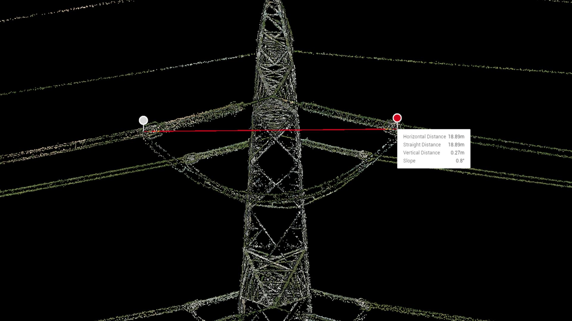
Precise 3D mapping and analysis of powerline corridors using LiDAR, measuring conductor sag, clearance, and structural integrity.
Capture geotagged video footage of powerlines and towers, enabling location-based analysis for inspections and documentation.
Conduct routine aerial inspections of transmission towers to detect corrosion, structural damage, or vegetation encroachments.
Our drone-based powerline surveys address critical needs in infrastructure maintenance, safety, and planning worldwide.
Create location-referenced video records for powerlines, supporting inspections, legal documentation, and monitoring.
Identify faults and structural issues in towers and conductors for timely repairs, minimizing outages and extending asset lifespan.
Accurate LiDAR and aerial data for planning new powerline routes, optimizing alignment and minimizing environmental impact.
Assess powerline conditions to ensure compliance with safety standards and mitigate risks from vegetation or structural failures.
Rapid surveys post-disaster to evaluate powerline damage and prioritize restoration efforts for affected infrastructure.
Monitor and manage vegetation encroachments along powerline corridors using drone imagery and LiDAR to prevent outages.