River Inspection & Survey by Agniforge
Utilizing advanced drones with LiDAR, thermal imaging, and video geotagging, we deliver precise and comprehensive river surveys worldwide.
Download Profile
Utilizing advanced drones with LiDAR, thermal imaging, and video geotagging, we deliver precise and comprehensive river surveys worldwide.
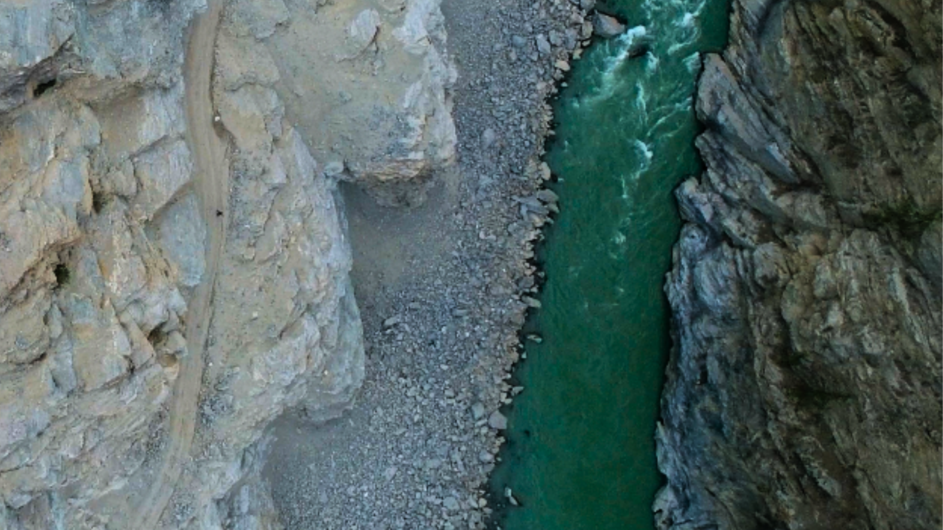
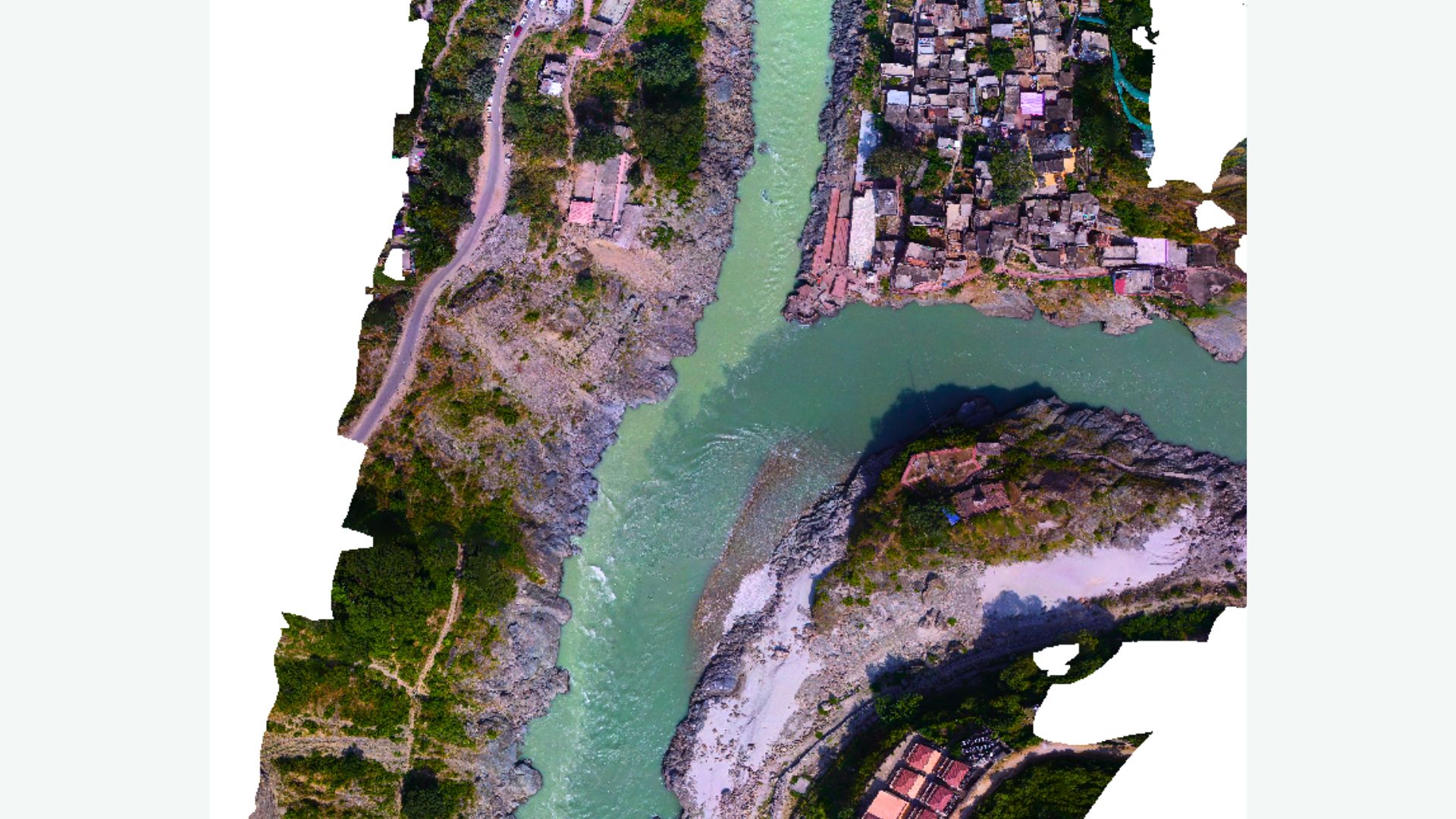
Download ProfileAt Agniforge, our drone-based river surveys leverage cutting-edge UAVs equipped with LiDAR, thermal imaging, high-resolution cameras, and video geotagging capabilities to provide precise and efficient data collection. This technology enables detailed assessments of river flow velocity, cross-sections, and topography across diverse and remote riverine environments.
Our expert team processes aerial data, geotagged videos, and LiDAR point clouds to map river channels, analyze sediment dynamics, and monitor floodplain conditions, delivering actionable insights for water resource management, flood risk assessment, and environmental conservation. Services like bathymetric mapping and thermal inspections enhance our ability to detect underwater features and groundwater inflows.
With a commitment to innovation and adherence to global environmental standards, Agniforge’s drone surveys offer survey-grade results for river management. Partner with us to optimize your river monitoring and planning efforts.
Our drone-based river survey services leverage advanced UAV technology for precise measurement of river characteristics, topography, and environmental conditions.
High-precision 3D mapping of river topography and cross-sections using LiDAR, enabling accurate modeling of channel geometry and terrain.
Capture geotagged video footage to analyze river flow velocity and surface dynamics, supporting hydrological studies and monitoring.
Detect groundwater inflows or thermal anomalies in rivers using thermal imaging, aiding in water source identification and environmental studies.
Map riverbed depths and underwater features using specialized UAV sensors, supporting navigation, dredging, and ecological assessments.
Our drone-based river surveys address critical needs in water resource management, environmental conservation, and infrastructure planning worldwide.
Accurate river flow velocity and cross-section data for developing hydrological models to predict water flow and flood risks.
Detailed topographic and LiDAR data to map floodplains, supporting flood risk assessment and mitigation planning.
Monitor sediment deposition and erosion patterns to inform river management and ecological restoration efforts.
Assess river health and detect groundwater inflows using thermal and video surveys to ensure compliance with environmental standards.
Provide topographic and bathymetric data for planning bridges, dams, or other river-related infrastructure projects.
Rapid post-disaster surveys to assess river channel changes and damage, prioritizing recovery and restoration efforts.