Pipeline Inspection & Survey by Agniforge
Utilizing advanced drones with thermal imaging, LiDAR, and video geotagging, we deliver precise and comprehensive pipeline inspections worldwide.
Download Profile
Utilizing advanced drones with thermal imaging, LiDAR, and video geotagging, we deliver precise and comprehensive pipeline inspections worldwide.
Download ProfileAt Agniforge, our drone-based pipeline surveys leverage state-of-the-art UAVs equipped with thermal imaging, LiDAR, high-resolution cameras, and video geotagging capabilities to provide precise and efficient inspections. This technology enables rapid data collection across extensive pipeline networks, including remote or hazardous areas, ensuring safety and operational reliability.
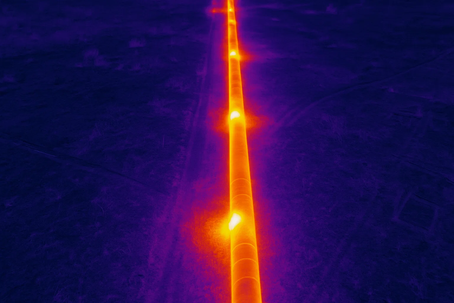
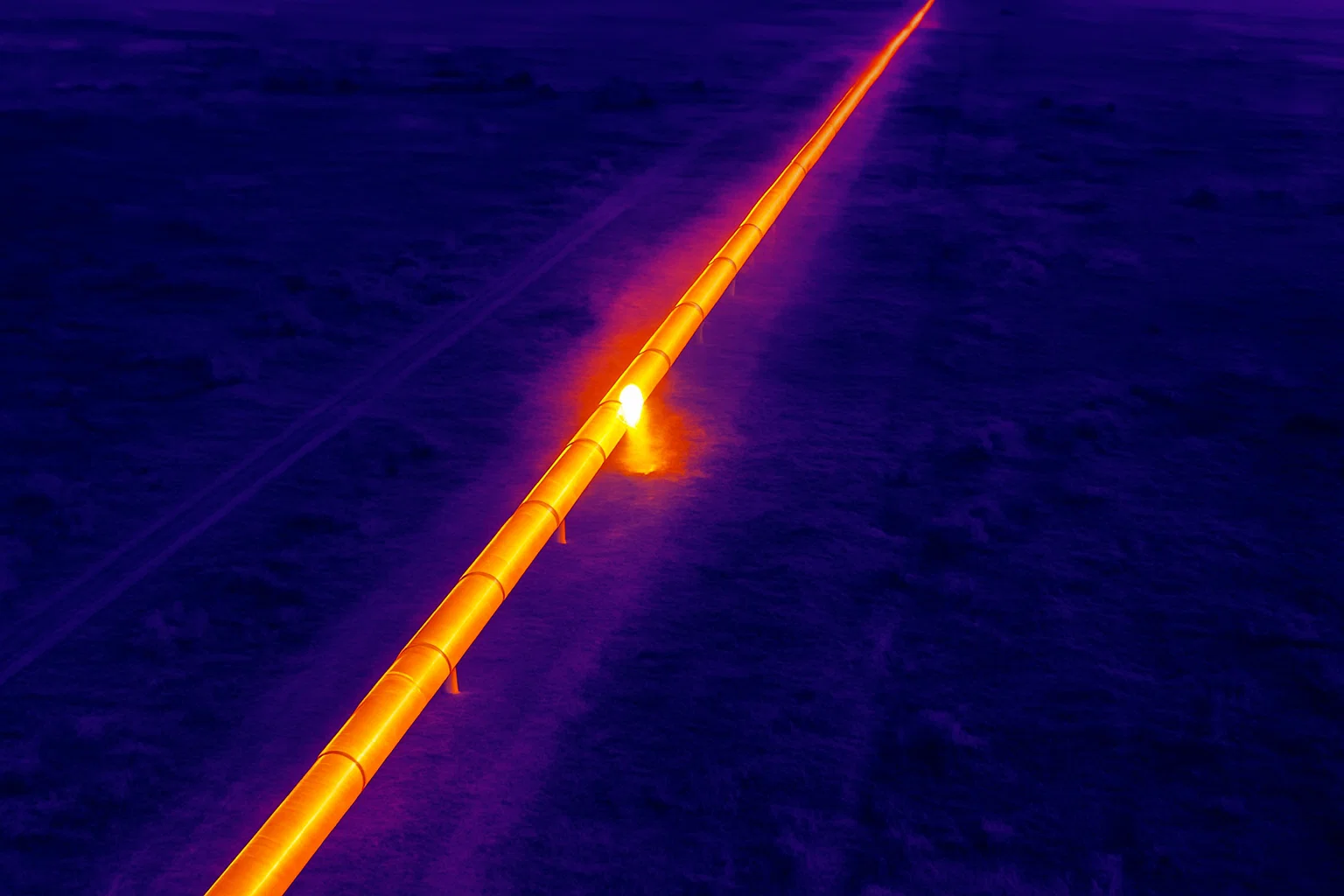
Our expert team processes aerial data, geotagged videos, and LiDAR point clouds to detect leaks, identify encroachments, monitor pipeline conditions, and plan routes, delivering actionable insights for maintenance and safety. Services like thermal inspections for leakage detection and change detection for encroachments enhance pipeline integrity and compliance.
With a commitment to innovation and adherence to global pipeline industry standards, Agniforge’s drone surveys offer survey-grade results for pipeline management. Partner with us to ensure the safety and longevity of your pipeline infrastructure.
Our drone-based pipeline survey services leverage advanced UAV technology for comprehensive inspections, route planning, and monitoring.
Identify pipeline leaks and anomalies using thermal imaging, enabling early intervention to prevent losses and environmental damage.
Monitor pipeline rights-of-way with high-resolution imagery to detect unauthorized encroachments or land-use changes.
Capture geotagged video footage of pipelines, enabling precise location-based analysis for inspections and documentation.
Precise 3D mapping and analysis of pipeline corridors using LiDAR, supporting route planning and structural assessments.
Our drone-based pipeline surveys address critical needs in infrastructure maintenance, safety, and planning worldwide.
Create location-referenced video records for pipelines, supporting inspections, compliance, and project monitoring.
Detect leaks and structural issues for timely repairs, minimizing downtime and ensuring pipeline integrity.
Accurate LiDAR and aerial data for planning new pipeline routes, optimizing alignment and minimizing environmental impact.
Identify unauthorized activities or encroachments along pipeline corridors to ensure safety and compliance.
Conduct routine aerial inspections to assess pipeline conditions, ensuring long-term reliability and safety.
Monitor pipeline surroundings to assess environmental impacts and ensure compliance with regulatory standards.