Monthly UAV Solar Inspection Annual Package — Book Now! Monthly UAV Mines Mapping & Survey Annual Package — Book Now!
Phone: +91-7982454976 | Email: contact@agniforge.com Agniforge Access
river

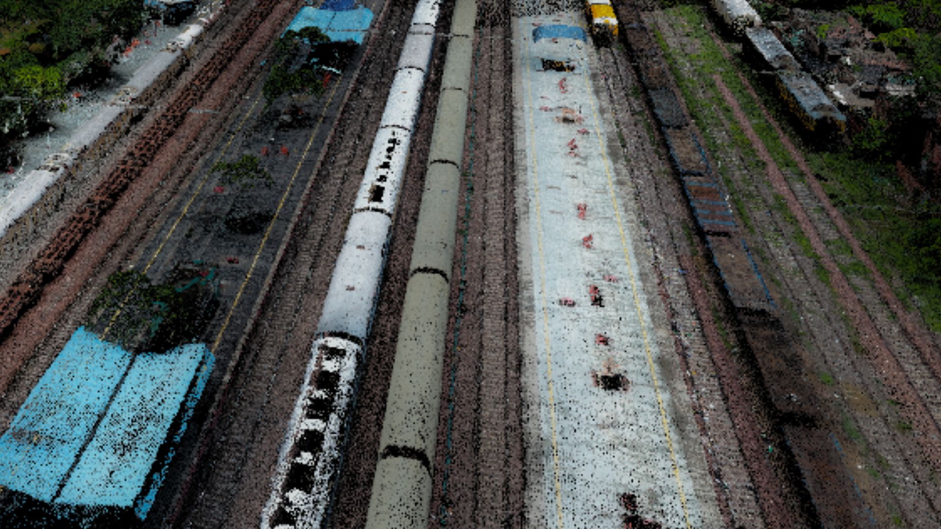
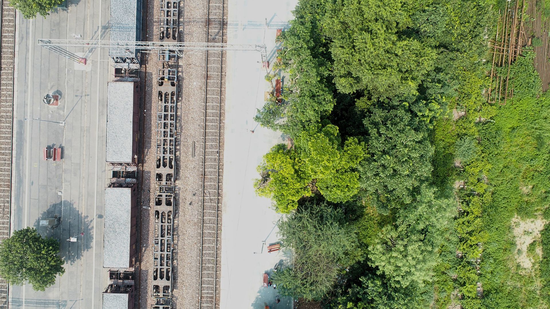
Railway mapping & survey by Agniforge

Agniforge offers specialized railway mapping and survey services, delivering high-precision geospatial data to support planning, construction, maintenance, and safety of railway networks. Our advanced drone and satellite technologies ensure accurate alignment mapping, corridor analysis, and asset monitoring for efficient railway project execution.

Download Profile

About Agniforge Drone Railways Surveys

At Agniforge, our drone-based railway surveys harness cutting-edge UAVs equipped with LiDAR, high-resolution cameras, thermal imaging, and video geotagging capabilities to deliver precise and efficient inspections. This technology enables rapid data collection and geotagged video documentation across extensive railway networks, including remote or hazardous areas.

Our expert team processes aerial data and geotagged videos to evaluate track conditions, overhead lines, and surrounding infrastructure, providing actionable insights for railway maintenance and safety. Drone surveys minimize operational disruptions and enhance safety by reducing the need for on-site personnel.

With a commitment to innovation and excellence, Agniforge’s drone surveys deliver survey-grade results that meet global railway standards. Partner with us to optimize your railway infrastructure management.

Drone Railways Survey Services

Drone Railways Survey Services

Our drone-based railway survey services, including video geotagged surveys, leverage advanced technology for comprehensive and efficient inspections.

Video Geotagged Survey

Capture geotagged video footage of railway tracks and infrastructure, enabling precise location-based analysis for maintenance and documentation.

Aerial Track Inspection

High-resolution drone imagery to assess track conditions, detecting rail wear, misalignments, and ballast issues for maintenance planning.

LiDAR Corridor Mapping

Precise 3D mapping of railway corridors using LiDAR, supporting alignment verification and expansion projects.

Thermal Anomaly Detection

Thermal imaging to identify overheating components or vegetation encroachments, enhancing railway safety and reliability.

Applications of Drone Railways Surveys

Our drone-based railway surveys, including video geotagged surveys, address critical needs in infrastructure maintenance, safety, and planning worldwide.

Geotagged Video Documentation

Create location-referenced video records for railways, supporting inspections, legal documentation, and project monitoring.

Track Maintenance Planning

Identify track defects for timely repairs, ensuring safe operations and extending infrastructure lifespan.

Railway Expansion Design

Accurate 3D models for planning railway expansions, ensuring alignment and terrain compatibility.

Safety Audits

Assess track and infrastructure conditions to enhance safety and compliance with railway standards.

Construction Progress Monitoring

Track railway construction progress with aerial data, ensuring adherence to timelines and specifications.

Disaster Damage Assessment

Rapid surveys post-disaster to evaluate railway damage and prioritize recovery efforts.

Join Us in Shaping the Future

Partner with Agniforge Survey to unlock the potential of your land with precision, innovation, and purpose. Let’s build a sustainable tomorrow together.

Get in Touch
Agniforge Survey Chatbot
💬
Agniv