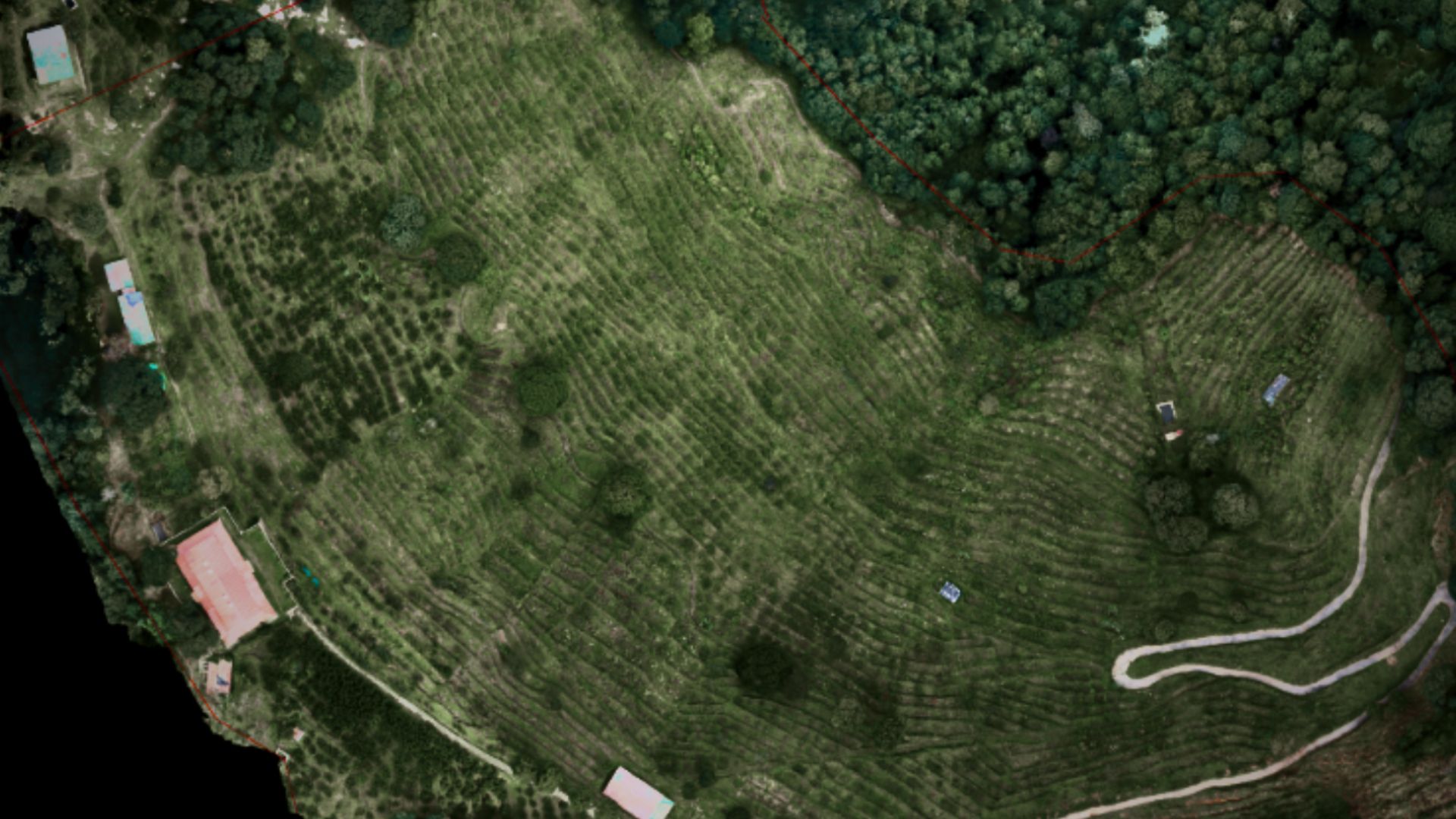
UAV Mapping & Survey
High-precision aerial mapping using advanced drones for accurate topographic data and detailed site analysis.
Learn More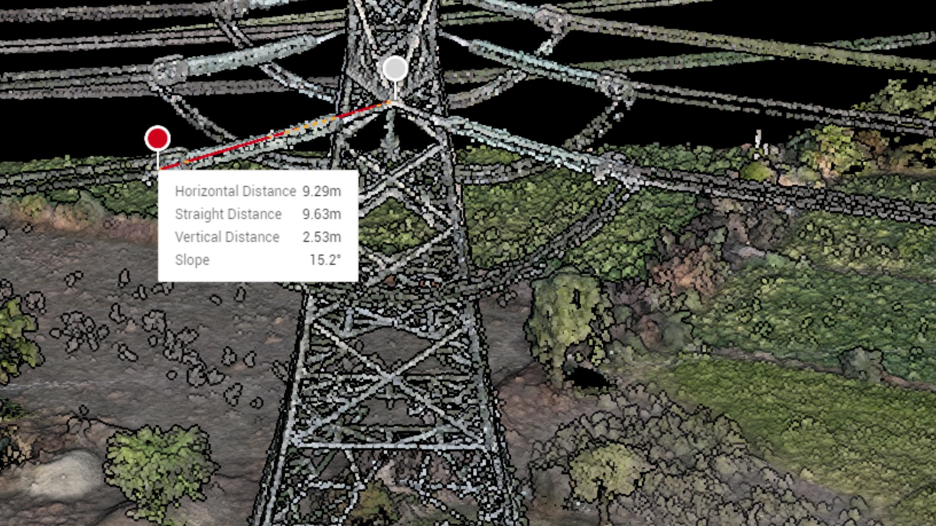
LiDAR Survey
Advanced laser scanning for detailed 3D models, ideal for complex terrains and infrastructure projects.
Learn More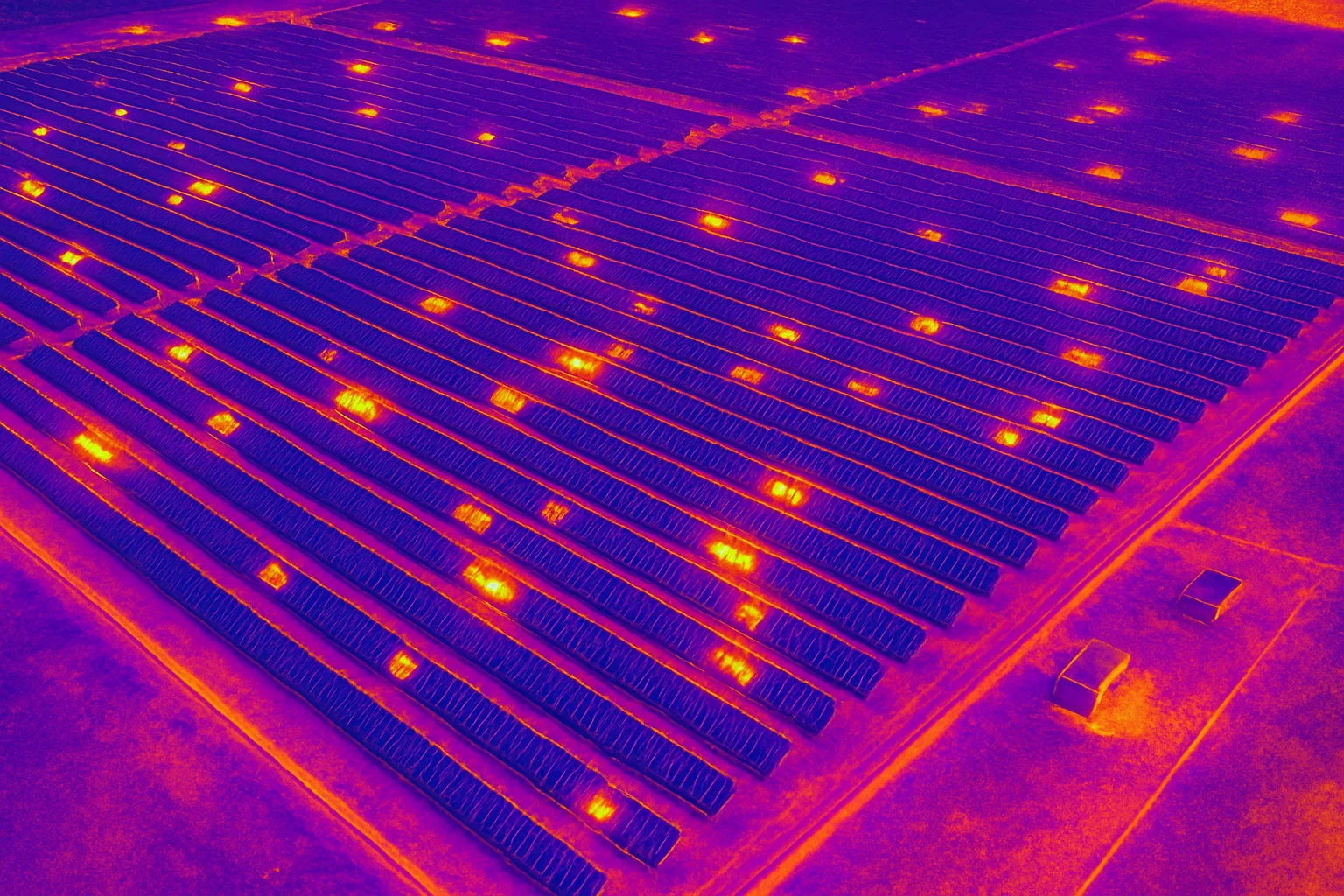
Thermal Inspection
Infrared imaging to detect heat leaks, electrical faults, and structural issues with precision.
Learn More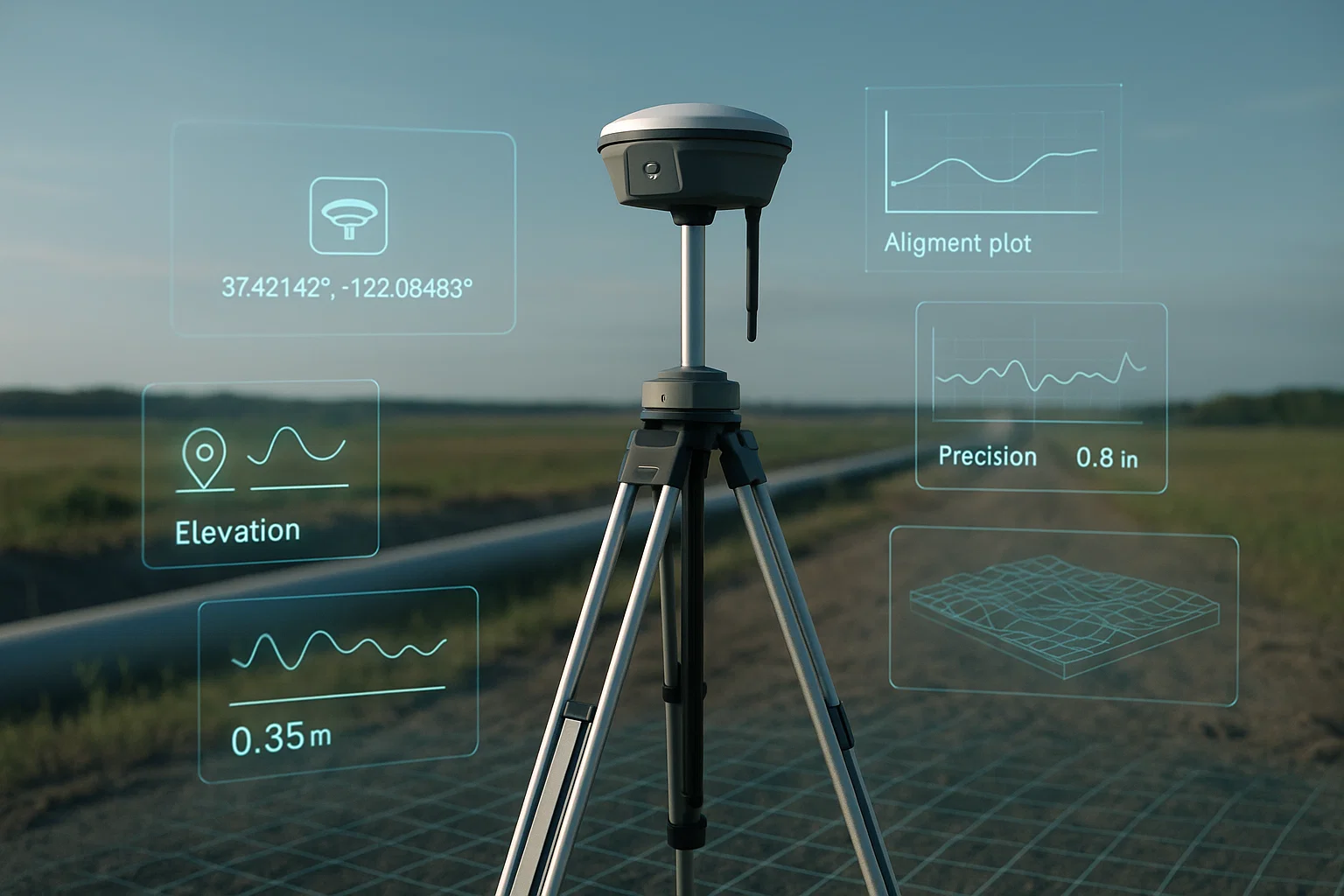
DGPS Survey
Differential GPS technology for centimeter-level accuracy in land and boundary surveys.
Learn More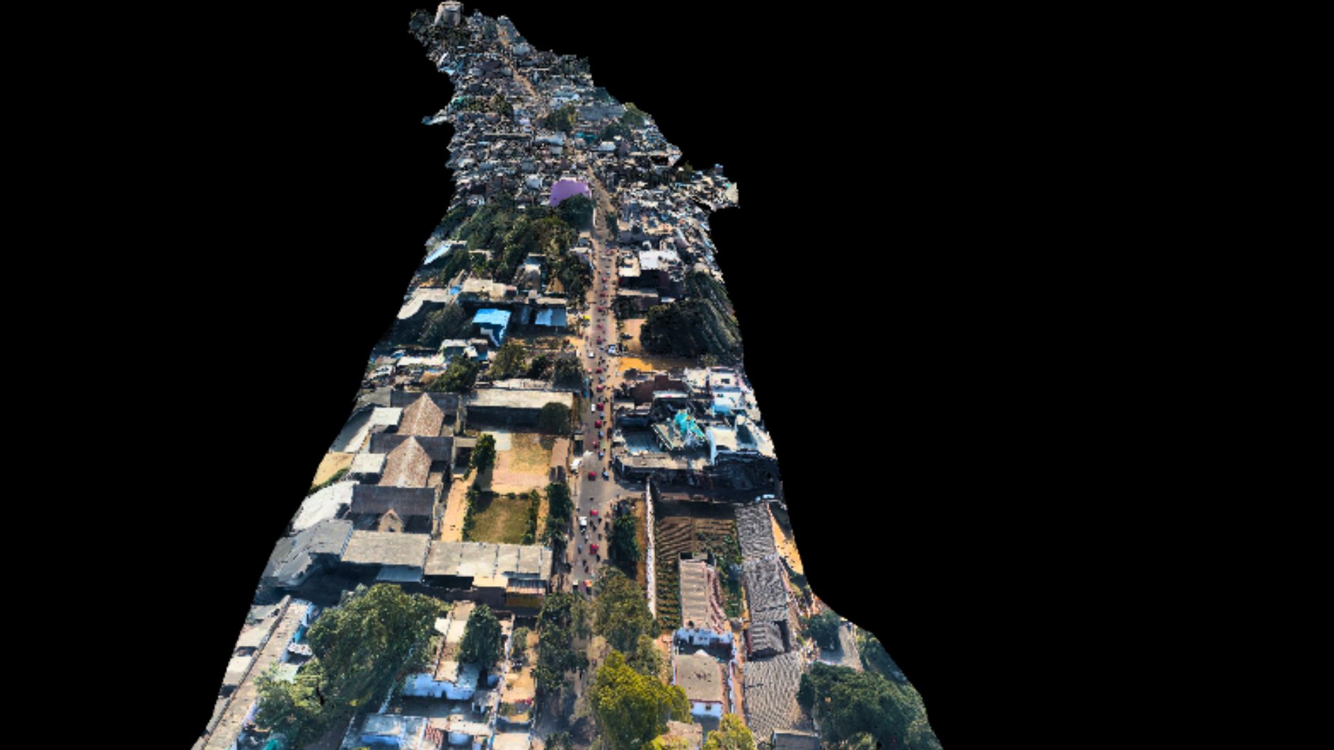
Property Survey
Comprehensive surveys for property boundaries, ownership verification, and development planning.
Learn More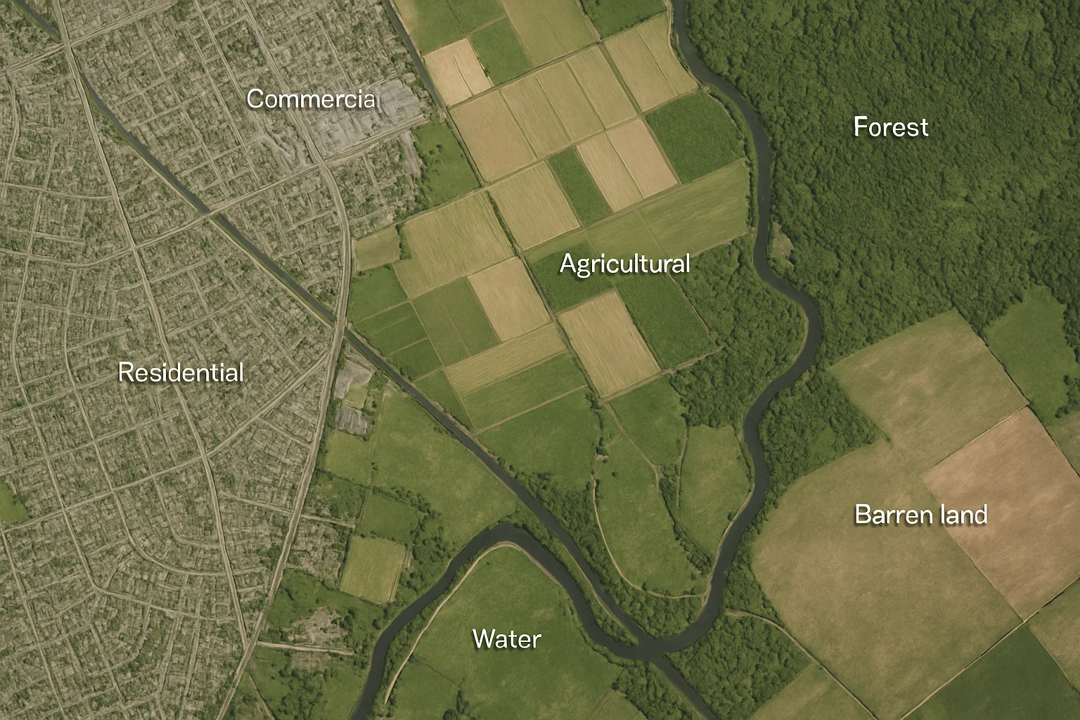
Satellite Mapping
High-resolution satellite imagery for large-scale mapping and environmental monitoring.
Learn More