Monthly UAV Solar Inspection Annual Package — Book Now! Monthly UAV Mines Mapping & Survey Annual Package — Book Now!
Phone: +91-7982454976 | Email: contact@agniforge.com Agniforge Access
UAV Survey

Precision Surveying with Agniforge

Unlock the potential of your land with cutting-edge UAV and LiDAR technology in Belgium.

Aerial Mapping

Mapping the Future

From urban planning to agriculture, our solutions drive progress.

Land Survey

Sustainable Insights

Eco-conscious surveying for a better tomorrow.

The Essence of Agniforge Survey

Weaving precision into progress, Agniforge Survey transforms landscapes into legacies with unwavering dedication and visionary technology.

A Legacy of Vision and Precision

At Agniforge Survey, we are driven by a timeless passion for charting the world with unparalleled accuracy. Rooted in decades of expertise, our journey is one of innovation, where every measurement tells a story of progress. From the fertile fields of Muzaffarpur to global horizons, we honor the craft of surveying by blending tradition with cutting-edge tools like UAVs, LiDAR, and satellite imagery.

Our mission is to empower industries—construction, agriculture, urban planning, and beyond—with insights that shape a sustainable future. With every project, we forge connections between land and ambition, crafting solutions that endure. Agniforge is more than a survey company; it’s a beacon of trust, precision, and transformation.

Discover Our Story
Agniforge Vision

Our Services

Agniforge Survey delivers cutting-edge solutions tailored to your needs, leveraging advanced technology for precision and efficiency in Belgium.
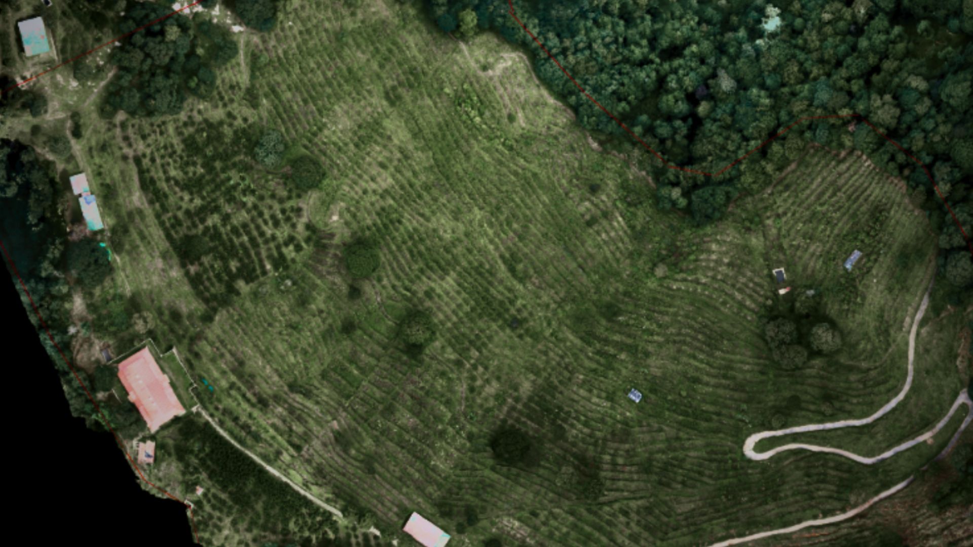
UAV Mapping & Survey

UAV Mapping & Survey

High-precision aerial mapping using advanced drones for accurate topographic data and detailed site analysis.

LiDAR Survey

LiDAR Survey

Advanced laser scanning for detailed 3D models, ideal for complex terrains and infrastructure projects.
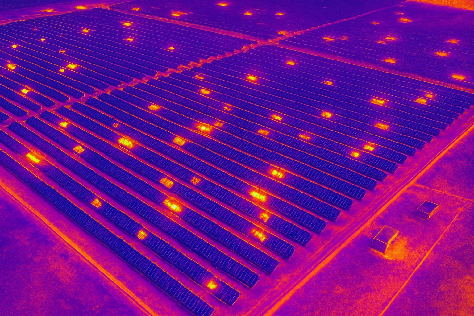
Thermal Inspection

Thermal Inspection

Infrared imaging to detect heat leaks, electrical faults, and structural issues with precision.
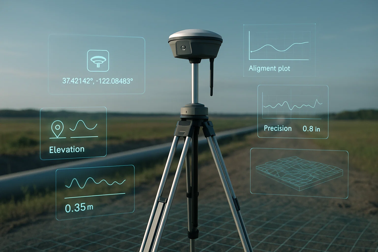
DGPS Survey

DGPS Survey

Differential GPS technology for centimeter-level accuracy in land and boundary surveys.
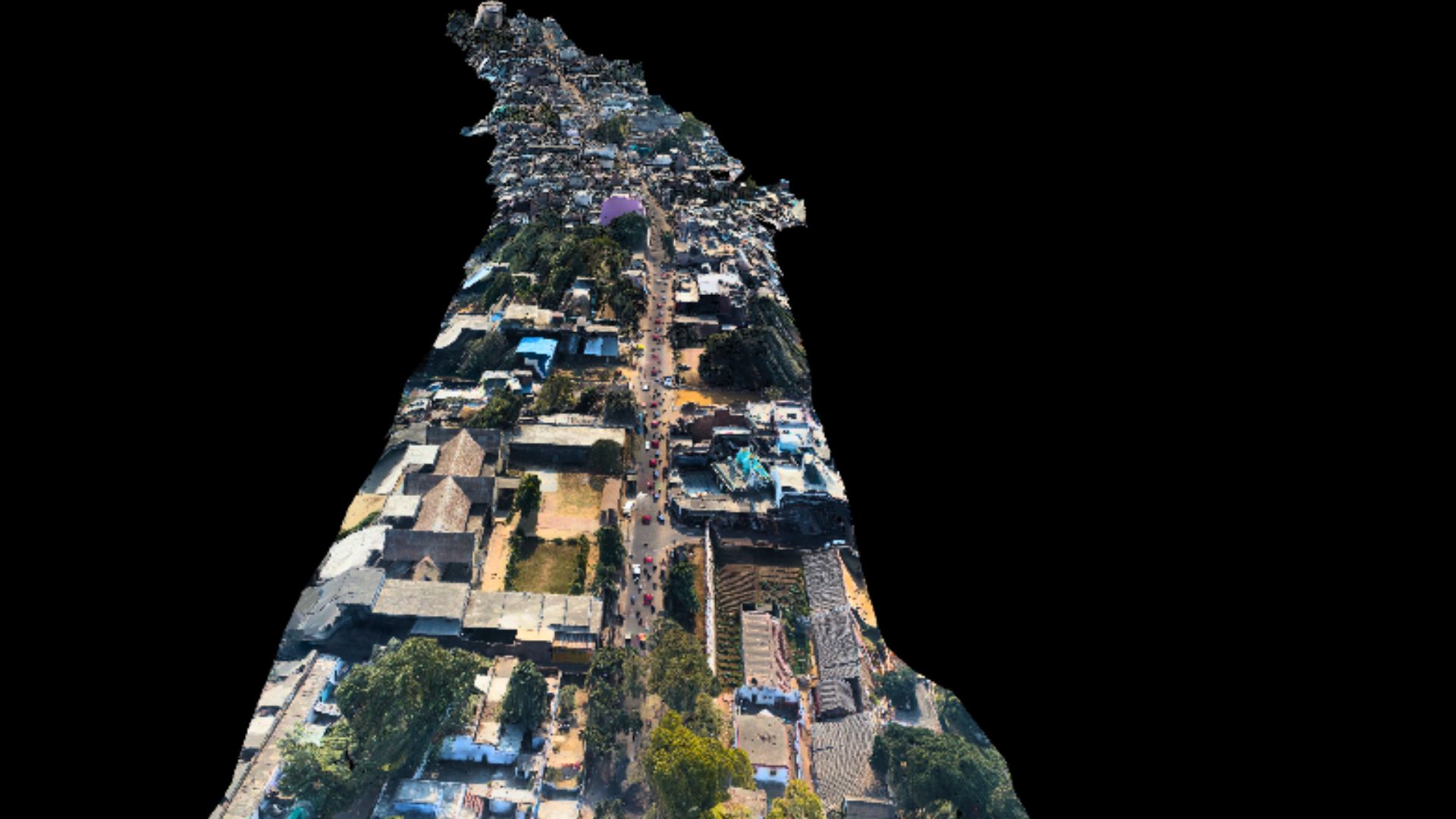
Property Survey

Property Survey

Comprehensive surveys for property boundaries, ownership verification, and development planning.
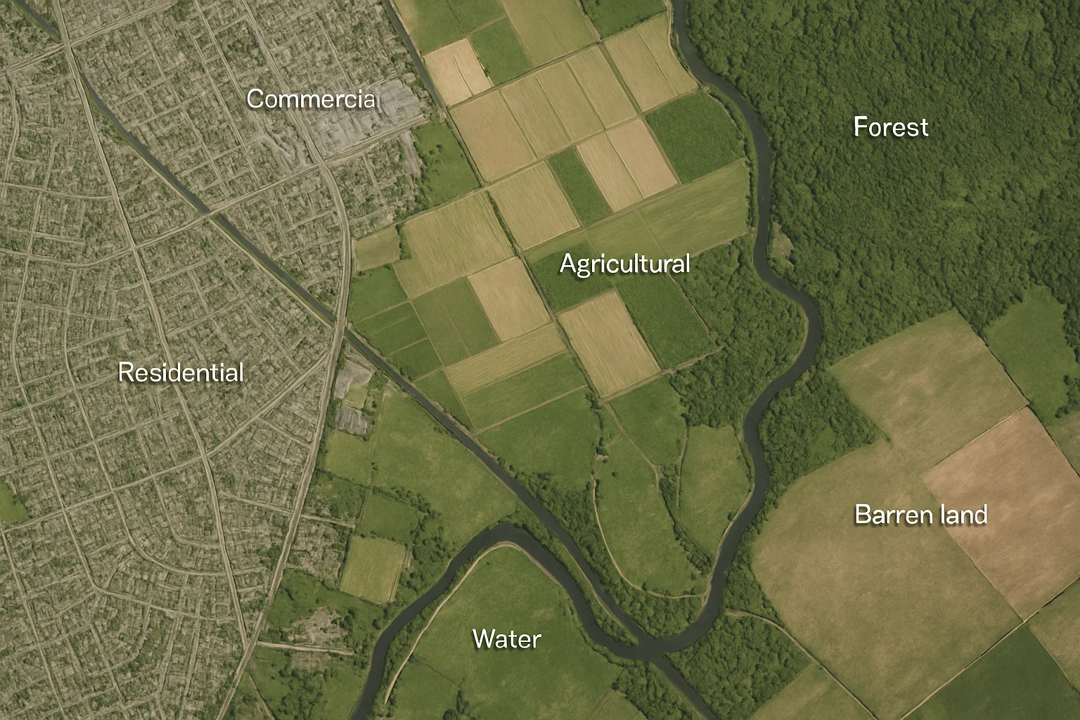
Satellite Mapping

Satellite Mapping

High-resolution satellite imagery for large-scale mapping and environmental monitoring.

Our Limited-Time Offers

Get the best-in-class UAV and Surveying services with unbeatable annual plans!

Solar Inspection Plan

Monthly drone inspection with thermal analytics and detailed report delivery.

₹15,00,000 / year
Explore

Mining Survey Plan

Volumetric analysis, LiDAR scans & terrain mapping of mining zones monthly.

₹10,00,000 / year
Explore

Why Choose Us

At Agniforge Survey, we deliver unmatched expertise, global reach, and transparency to ensure your projects succeed.

Operating Globally

Our services span the globe, delivering precise surveying solutions tailored to diverse regions and industries.

170+ Expert Pilots

With over 70 pilots across India and 170+ globally, our skilled team ensures precision in every project.

Transparent & Timely Updates

Track every stage of your project with real-time updates, ensuring transparency and on-time execution.

Industries We Serve

Agniforge Survey empowers diverse sectors with precision mapping and innovative solutions, driving progress across the globe.

Infrastructure & Construction

  • Bridge Inspection
  • Dam Inspection
  • Highway Mapping
  • Railway Mapping & Survey

Energy & Utilities

  • Powerline Monitoring
  • Solar Plant Inspection
  • Pipeline Inspection

Mining & Resource Extraction

  • Minesite Mapping
  • Stockpile Volumetric Survey

Agriculture & Forestry

  • Agriculture Monitoring & Mapping
  • Forest Survey & Mapping

Urban Planning & Development

  • Smart City Mapping

Environmental & Water Management

  • River Mapping

Our Achievements

With a legacy of precision and innovation, Agniforge Survey delivers impactful results across the globe.

0

Flying Hours

0

Hectares Surveyed

0

Countries Worked In

Trusted by Leading Organizations

We are proud to partner with industry leaders who rely on our precision and expertise in surveying and mapping.


Our Past Projects

Explore some of our successful projects, showcasing our expertise in precision surveying and mapping across various industries.

Land survey in Nigeria by Agniforge

Minesite survey at Edo, Kogi, Bijim, Iguigbe in Nigeria

Conducted a detailed survey covering over 20,000 sqkm of bauxite-rich terrain, providing accurate topographic and geological data for mining operations.

Location:Edo & Kogi, Nigeria
Year: 2018

View Details
Minesite survey

Topography survey at Tagoung Tong, Myanmar

Conducted a topographic survey at Tagoung Tong, Myanmar, utilizing drone and GNSS technologies to capture precise elevation data, contours, and surface features for planning and engineering applications.

Location: Tagoung Tong, Myanmar
Year: 2022

View Details
Minesite survey

Topography & soil testing survey at Zimbabwe

Conducted a topographic and soil testing survey in Zimbabwe, integrating elevation mapping with on-ground soil analysis to support agricultural planning, land development, and environmental assessment.

Location: Tagoung Tong, Myanmar
Year: 2022

View Details
Minesite survey

UAV LIDAR survey of transmission tower at MP, India

Executed a UAV LiDAR survey of transmission towers in Madhya Pradesh, India, capturing high-density point cloud data for precise structural modeling, clearance analysis, and asset management of power infrastructure.

Location: Madhya Pradesh, India
Year: 2025

View Details
Solar Plant Inspection

Thermal inspection of transmission tower at Jharkhand

Performed a thermal inspection of transmission towers in Jharkhand using drone-mounted infrared sensors to detect hotspots, assess structural integrity, and ensure preventive maintenance of critical power infrastructure.

Location: Jharkhand, India
Year: 2022

View Details
Drone Survey & Mapping

UAV Mapping & survey at Delhi Cantt. Railway Station (1st & 2nd phase)

Conducted UAV mapping and survey at Delhi Cantt. Railway Station in two phases, with a one-year interval between them, providing high-accuracy geospatial data to support phased redevelopment, platform alignment, and infrastructure planning.

Location: Delhi, India
Year: 2023 & 2024

View Details
Solar Plant Inspection

Video geotagged survey using drone for NHAI

Carried out a geotagged video survey using drones along the route from Kishangarh to Beawar, capturing continuous visual and location-based data to support road condition assessment, alignment verification, and infrastructure planning.

Location: Rajasthan, India
Year: 2021

View Details
Solar Plant Inspection

Drone Survey at Mistletoe & Somerfort, Ramgarh, Uttarakhand

Performed a high-resolution drone survey in the hilly terrain of Rampur, Uttarakhand, capturing precise elevation and land features to support infrastructure planning and environmental assessment.

Location: Uttarakhand, India
Year: 2021

View Details
Solar Plant Inspection

Drone Survey at Tughlakabad Railway yard

Conducted a detailed drone survey at Tughlakabad Railway Yard, capturing high-resolution aerial data to assist in yard planning, asset mapping, encroachment inspection and operational efficiency enhancement.

Location: Delhi, India
Year: 2021

View Details
Smart City Mapping

UAV Mapping & Survey at Shahjahanpur, UP, India

Executed a UAV-based mapping and survey in Shahjahanpur, Uttar Pradesh, capturing detailed geospatial data of city roads to aid in urban planning, road design, and infrastructure development.

Location:Shahjahanpur, UP, India
Year: 2021

View Details

Latest Articles

The Pave Surveyor Network Survey Vehicle (NSV) deployed on-site for pavement condition assessment and road corridor data collection.

Road and Highway Corridor Surveys with Pave Surveyor NSV

Road and highway networks are the lifelines of any...

View Details
 A high-resolution aerial view of the river corridor captured during our drone survey, providing detailed imagery for precise mapping and analysis of riverbanks and adjacent floodplains.

How We Conduct River Surveys Using Drone, DGPS, and Indigenous Sonar System with Boat

Accurate river surveys are essential for water res...

View Details

Placeholder

Coming Soon

Stay tuned for more updates!

Read More on Our Blog

Explore additional articles and insights on our main blog page.

Visit Blog

Join Us in Shaping the Future

Partner with Agniforge Survey in Belgium to unlock the potential of your land with precision, innovation, and purpose. Lets build a sustainable tomorrow together.

Get in Touch
Agniforge Survey Chatbot
💬
Agniv